Ditapis dengan
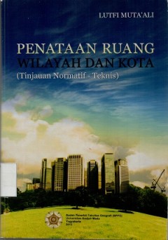
Penataan ruang wilayah dan kota: tinjauan normatif-teknis
Penataan ruang merupakan isu strtategis dalam pembangunan, dikarenakan semua kegiatan pembangunan khususnya pemanfaatan ruang harus mengacu pada rencana tata ruang dan menjadi jawaban dari persoalan bangsa yang semakin kompleks baik ekonomi maupun lingkungan. Melalui penataan ruang, pembangunan diharapkan dapat diselenggarakan secara terpadu baik lintas sektor, lintas wilayah, maupun lintas pem…
- Edisi
- -
- ISBN/ISSN
- 978-979-8786-45-7
- Deskripsi Fisik
- xxi, 521 hlm. : illus.
- Judul Seri
- -
- No. Panggil
- 711.4 LUT p

Pemetaan morfometri bentanglahan untuk perencanaan pembangunan
Pada konsep perencanaan pengembangan suatu wilayah, salah satu faktor yang harus diperhatikan di dalamnya adalah kondisi fisik atau lingkungan suatu wilayah atau morfometri. Kondisi fisik atau lingkungan akan sangat menentukan arah kebijakan dalam perencanaan pengembangan suatu wilayah. Faktor kondisi fisik Tu lingkungan wilayah harus tersedia dan selalu dalam kondisi terukur, sehingga ketersed…
- Edisi
- -
- ISBN/ISSN
- 978-602-9439-97-7
- Deskripsi Fisik
- 160 hlm. : illus.; 22 cm
- Judul Seri
- -
- No. Panggil
- Buku.Karya 2018/232.I RIZ p

A method for vertical adjustment of digital aerial photogrammetry data by usi…
The accuracy of vertical position information can be degraded by various sources of error in digital aerial photogrammetry (DAP) based point clouds. To address this issue, we propose a relatively straightforward method for automated correction of such point clouds. This method can be used in conjunction with any 3D reconstruction method in which a point cloud is generated from a pair of aerial …
- Edisi
- Vol.84, February 2020
- ISBN/ISSN
- 1569-8432
- Deskripsi Fisik
- 9 hlm PDF, 1.547 KB
- Judul Seri
- International Journal of Applied Earth Observation and Geoinformation - Open Access
- No. Panggil
- 910.285

The role of artificial intelligence and IoT in prediction of earthquakes: Review
Earthquakes are classified as one of the most devastating natural disasters that can have catastrophic effects on the environment, lives, and properties. There has been an increasing interest in the prediction of earthquakes and in gaining a comprehensive understanding of the mechanisms that underlie their generation, yet earthquakes are the least predictable natural disaster. Satellite data, g…
- Edisi
- Vol.5, December 2024
- ISBN/ISSN
- 2666-5441
- Deskripsi Fisik
- 19 hlm PDF, 5.965 KB
- Judul Seri
- Artificial Intelligence in Geosciences
- No. Panggil
- 551
Pore size classification and prediction based on distribution of reservoir fl…
Pore size analysis plays a pivotal role in unraveling reservoir behavior and its intricate relationship with confined fluids. Traditional methods for predicting pore size distribution (PSD), relying on drilling cores or thin sections, face limitations associated with depth specificity. In this study, we introduce an innovative framework that leverages nuclear magnetic resonance (NMR) log data, …
- Edisi
- Vol.5, December 2024
- ISBN/ISSN
- 2666-5441
- Deskripsi Fisik
- 23 hlm PDF, 24.240 KB
- Judul Seri
- Artificial Intelligence in Geosciences
- No. Panggil
- 551
Estimation of dusk time F-region electron density vertical profiles using LST…
The vertical profile of the ionosphere density plays a significant role in the development of low-latitude Equatorial Plasma Bubbles (EPBs), that in turn lead to ionospheric scintillation which can severely degrade precision and availability of critical users of the Global Navigation Satellite System (GNSS). Accurate estimation of ionospheric delays through vertical electron density profiles is…
- Edisi
- Vol.4, December 2023
- ISBN/ISSN
- 2666-5441
- Deskripsi Fisik
- 11 hlm PDF, 9.300 KB
- Judul Seri
- Artificial Intelligence in Geosciences
- No. Panggil
- 551
MLReal: Bridging the gap between training on synthetic data and real data app…
Among the biggest challenges we face in utilizing neural networks trained on waveform (i.e., seismic, electromagnetic, or ultrasound) data is its application to real data. The requirement for accurate labels often forces us to train our networks using synthetic data, where labels are readily available. However, synthetic data often fail to capture the reality of the field/real experiment, and w…
- Edisi
- Vol.3, December 2022
- ISBN/ISSN
- 2666-5441
- Deskripsi Fisik
- 14 hlm PDF, 3.698 KB
- Judul Seri
- Artificial Intelligence in Geosciences
- No. Panggil
- 551
Wavefield solutions from machine learned functions constrained by the Helmhol…
Solving the wave equation is one of the most (if not the most) fundamental problems we face as we try to illuminate the Earth using recorded seismic data. The Helmholtz equation provides wavefield solutions that are dimensionally reduced, per frequency, compared to the time domain, which is useful for many applications, like full waveform inversion. However, our ability to attain such wavefield…
- Edisi
- Vol.2, December 2021
- ISBN/ISSN
- 2666-5441
- Deskripsi Fisik
- 9 hlm PDF, 3.131 KB
- Judul Seri
- Artificial Intelligence in Geosciences
- No. Panggil
- 551
The potential of self-supervised networks for random noise suppression in sei…
Noise suppression is an essential step in many seismic processing workflows. A portion of this noise, particularly in land datasets, presents itself as random noise. In recent years, neural networks have been successfully used to denoise seismic data in a supervised fashion. However, supervised learning always comes with the often unachievable requirement of having noisy-clean data pairs for tr…
- Edisi
- Vol.2, December 2021
- ISBN/ISSN
- 2666-5441
- Deskripsi Fisik
- 13 hlm PDF, 7.813 KB
- Judul Seri
- Artificial Intelligence in Geosciences
- No. Panggil
- 551

Predictive regressive models of recent marsh sediment thickness improve the q…
Coastal marsh wetlands experience variations in vertical gains and losses through time, which have allowed them to infill relict topography and record variations in drivers. The stratigraphic unit associated with the development of the marsh also reflects the long-term importance of key ecosystem services supplied by the marsh environment, including carbon storage and storm mitigation. Mapping …
- Edisi
- Vol.25, February 2025
- ISBN/ISSN
- 2590-1974
- Deskripsi Fisik
- 12 hlm PDF, 5.867 KB
- Judul Seri
- Applied Computing and Geoscience - Open Access
- No. Panggil
- 551.136
 Batas Wilayah
 Ekologi
 Fotogrametri
 Geografi
 Geologi
 GIS
 Ilmu Tanah
 Kartografi
 Manajemen Bencana
 Oceanografi
 Penginderaan Jauh
 Peta