Ditapis dengan

Datum transformation for leveling networks (Dok.10/1988)
Prior to the advent of modern computers, leveling network adjusments were performed by the condition method. The Datumproblem did not appear in the context of this adjusment technique. The datum problem, of course, always existed but it was dealt with independently, outside of the adjusment calculation. In the following the datum transformations are shown for both, the condition adjustment tech…
- Edisi
- -
- ISBN/ISSN
- -
- Deskripsi Fisik
- -
- Judul Seri
- -
- No. Panggil
- Dokumen 1988/10 BAD d

Spesifikasi teknis pemetaan terintegrasi kepurbakalaan Sriwijaya (Dok.12/ST/I…
Kegiatan ini bertujuan untuk melanjutkan penelitian terintegrasi kepurbakalaan Sriwijaya dengan menerapkan teknik penginderaan jauh daerah Palembang dan Muara Jambi. Metode yang digunakan dalam penelitian ini adalah menggunakan metode survey bertingkat dengan teknik penginderaan jauh. Kegiatan ini meliputi analisa 80 pair foto, pengecekan teristrik, survey arkeologi dan deskripsinya.
- Edisi
- -
- ISBN/ISSN
- -
- Deskripsi Fisik
- -
- Judul Seri
- -
- No. Panggil
- Dokumen 1984/12/ST/INEV

Spesification for doppler station monumentation and description (Dok.27/1982)
There are two categori monuments to be planted in the field: a. Monument for geodetic control b. Monuments for mapping control Eventhough both types of monuments are to be fixed by Doppler positioning technique, the geodetic control ststions will be simultaneously adjusted in a frame of network at a later stage. The Geodetic stations are designed at a spacing of 300 kms (The zeroth order networ…
- Edisi
- -
- ISBN/ISSN
- -
- Deskripsi Fisik
- -
- Judul Seri
- -
- No. Panggil
- Dokumen 1982/27 BAD s

The Status of and problems associated with vertical control networks in Indon…
In Indonesia, particularly on the island of Jawa, there are numerous local level nets, most of them are linked to sea level via tide gauge observations. Some local system are related to a mean yearly sea level, others to mean high or mean low tides and also relation to the highest high tide or the lowest low tide does occur. There is no uniformity. In 1925 the then topographic service undertook…
- Edisi
- -
- ISBN/ISSN
- -
- Deskripsi Fisik
- -
- Judul Seri
- -
- No. Panggil
- Dokumen 1980/08 BAD s

Perkembangan organisasi dan kegiatan pemetaan nasional di Indonesia (Dok.No.0…
Fungsi pengelolaan Pemetaan Dasar dalam rangka Pemetaan Nasional, meliputi pemetaan di darat maupun di laut, yakni pemetaan topografi dan pemetaan hidrografi, yang erat hubungannya dengan inventarisasi sumberdaya alam, dan merupakan prasyarat pembangunan nasional. Dalam hubungan itu, makalah ini memberikan gambaran perkembangan mengenai pemetaan topografi dan pemetaan hidrografi sejak zaman kol…
- Edisi
- -
- ISBN/ISSN
- -
- Deskripsi Fisik
- -
- Judul Seri
- -
- No. Panggil
- Dokumen 1980/07 BAD p

Petunjuk pengumpulan nama-nama geografi dari peta skala 1:50.000 (Dok.No.15/1…
Gazetteer Nasional nama-nama Geografi yang diterbitkan oelh Bakosurtanal pertama kali memuat sejumlah 9760 nama yang disadap dari peta dunia skala 1: 1.000.000 (dokumen no. 12/1978). Nama -nama geografi tersebut telah disimpan dalam bentuk basis data dalam magtape. Sebagai tindak lanjut pengelolaan data-data dasar geografi dan perpetaan, dengan petunjuk dokumen ini akan dilaksanakan penyadapan …
- Edisi
- -
- ISBN/ISSN
- -
- Deskripsi Fisik
- -
- Judul Seri
- -
- No. Panggil
- Dokumen 1980/15 BAD p
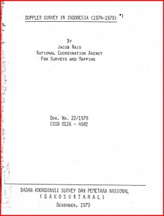
Doppler survey in Indonesia (1974-1979) (Dok.22/1979)
Indonesia has started the implementation of a systematic mapping programme of the country to provide base maps at scale of 1:50.000 for the inventory and evaluation of her vast natural as well as her socio-economic resources for teir visual presentation and storage in the resources information systems. For these purpose it is necessary for these maps to be based on unified coordinate system pro…
- Edisi
- -
- ISBN/ISSN
- -
- Deskripsi Fisik
- -
- Judul Seri
- -
- No. Panggil
- Dokumen 1979/22 BAD d

Laporan akhir bimbingan teknis penyusunan NSDA spasial di Prop. Babel, Bali, …
Secara garis besar maksud dari bimbingan teknis ini adalah pembinaan kualitas SDM Instansi Sektoral terkait dan Bappeda dengan cara memberikan pengetahuan praktis tentang cara inventarisasi data sumberdaya alam dengan bantuan inderaja dan SIG, pengolahan data primer dan sekunder untuk penyusunan NSASD yang diharapkan akan sejalan dengan otonomi daerah, sehingga daerah dapat mengelola dan menyus…
- Edisi
- -
- ISBN/ISSN
- -
- Deskripsi Fisik
- 30 hlm.; 18 cm.
- Judul Seri
- -
- No. Panggil
- 333.73Buku.Karya 2002/38 BAD l

Jaring kontrol geodesi nasional dengan pengukuran global positioning system d…
- Edisi
- -
- ISBN/ISSN
- -
- Deskripsi Fisik
- -
- Judul Seri
- -
- No. Panggil
- Dokumen 2004/02 BAD j
- Edisi
- -
- ISBN/ISSN
- -
- Deskripsi Fisik
- -
- Judul Seri
- -
- No. Panggil
- Dokumen 2004/02 BAD j

Plan of operation resource evaluation aerial photography Indonesia project nu…
The Purpose of this plan of operation is to record the understanding between BAKOSURTABNAL representing the goverment of the Republic of Indonesia and CIDA, representing the goverment of Canada, on the purpose of the project, the method and shedule for achieving that purpose, the resources required, and the means of managing and evaluating the achievement of the project purpose. The responsibil…
- Edisi
- -
- ISBN/ISSN
- -
- Deskripsi Fisik
- -
- Judul Seri
- -
- No. Panggil
- Dokumen 1984/08 BAD p
 Batas Wilayah
 Ekologi
 Fotogrametri
 Geografi
 Geologi
 GIS
 Ilmu Tanah
 Kartografi
 Manajemen Bencana
 Oceanografi
 Penginderaan Jauh
 Peta