Ditapis dengan

National resources survey and mapping project IBRD LOAN No.1197-IND: progress…
In this period the main ativities of the National Resources Survey and Mapping Project have been dedicated to the following: a. Construction of the laboratory building B. Design and development of the technological and institutional support systems and the introduction of above system c. Development of training facilities and conduct of training d. purchase of equipment e. Initiate the compilat…
- Edisi
- -
- ISBN/ISSN
- -
- Deskripsi Fisik
- -
- Judul Seri
- -
- No. Panggil
- Dokumen 1978/06 BAD n

Application of multi level remote sensing techniques for land cover mapping i…
The Method applied in this land cover mappiing is to use multi-level remote sensing techniques. The main source used in these techniques consist of two kinds of image: satellite imageries at the scale of 1:250.000 and black and white panchromatic aerial photographs at the scale of 1:10.000,1:20.000 and 1:50.000. The scale of land cover mapping made by using those aforementioned main sources is …
- Edisi
- -
- ISBN/ISSN
- -
- Deskripsi Fisik
- -
- Judul Seri
- -
- No. Panggil
- Dokumen 1985/09 BAD a

Keputusan Bersama Direktur Jenderal Penyiapan Pemukiman dan Badan Koordinasi …
Dokumen ini berisi tentang pedoman pengaturan kerjasama direktorat jenderal penyiapan pemukiman dengan Badan Koordinasi Survei dan Pemetaan Nasional berisi 6 pasal dan ditetapkan di Jakarta tanggal 29 Mei 1984.
- Edisi
- -
- ISBN/ISSN
- -
- Deskripsi Fisik
- -
- Judul Seri
- -
- No. Panggil
- Dokumen 1984/12 BAD k
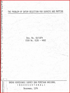
The Problem of datum selection for survey and mapping
This article tries in short to outline the siginificance of datum slection for survey and mapping which is not only applicable to land survey and mapping but also to the same activities at sea. The latter activities are increasing in the last decade due to (1) the great and rapdly increasing need for improved accuracy in measurement at sea and, (2) the state of the art that has been advanced to…
- Edisi
- -
- ISBN/ISSN
- -
- Deskripsi Fisik
- -
- Judul Seri
- -
- No. Panggil
- Dokumen 1974/02 BAD p

Fundamentals of control networks and the significance of gravity data in datu…
This paper reviews the fundamentals of control networks which form the mathematical frameworks to which subsequent mapping is related. The present situation of the existing networks in Indonesia will be given as well as the contemplated plan-With egard to geoid study as an essential art of datum definition in geodesy, gravity data and gravity network are the most concern of geodesists, and henc…
- Edisi
- -
- ISBN/ISSN
- -
- Deskripsi Fisik
- -
- Judul Seri
- -
- No. Panggil
- Dokumen 1975/08 BAD f

Interregional expert meeting on use of satellite imaging radar and thematic m…
This paper presents the state-of-art of satellite remote sensing in Indonesia. The national program on the use of satellite remote sensing for land based natural resource inventory and evaluation as well as the monitoring of environment. The problem of could cover is a constraint in utilizing optimally the present landsat series. Also presented the concept of using airborn as well as spaceborn …
- Edisi
- -
- ISBN/ISSN
- -
- Deskripsi Fisik
- -
- Judul Seri
- -
- No. Panggil
- Dokumen 1985/07 BAD i

Pedoman teknis pemetaan geomorfologi skala 1:250.000 (Dok.03/ST/INEV/1985)
Maksud dari kegiatan ini adalah untuk melakukan interpretasi bentuk lahan yang berwujud peta geomorfologi skala 1:250.000 . Secara sistematik dan analistis yang dilengkapi dengan pemeriannya atas dasar bentuk, proses, genesis, dan hubungan timbal balik kelingkungannya dalam susunan keruangan. Adapun tujuannya adalah mmberikan salah satu masukan informasi untuk evaluasi sumberdaya lahan dalam ra…
- Edisi
- -
- ISBN/ISSN
- -
- Deskripsi Fisik
- 34 hlm.; 28 cm.
- Judul Seri
- -
- No. Panggil
- Dokumen 1985/03/ST/INEV BAD p

CIDA plan of operations: aerial photography, Doppler satellite operations, Ai…
Cida Plan of operation (1) General; (2) Aerial Photography; (3) Doppler Satellite Receiver Operations; (4) Airbone Radar Altimetry; (5) Topographical Mapping Data Base.
- Edisi
- -
- ISBN/ISSN
- -
- Deskripsi Fisik
- -
- Judul Seri
- -
- No. Panggil
- Dokumen 1977/14 Bad c

Terms of reference a proposed technical assistance for the Institute for phot…
A Proposed technical assistance for the Institute photogrammetry and cartography (IPC) consists of background information; Follow-up Institute for photogrammetry and cartography-IPC; Expatriate support to IPC.
- Edisi
- -
- ISBN/ISSN
- -
- Deskripsi Fisik
- -
- Judul Seri
- -
- No. Panggil
- Dokumen 1978/24 BAD t

Jaring kontrol vertikal nasional petunjuk pengukuran sipat datar teliti, revi…
Tujuan dari buku petunjuk ini adalah untuk menyeragamkan cara pengadaan jaring kontrol vertikal nasional di Indonesia yang dilaksanakan dengan pengukuran sipat datar teliti. Cara yang dipilih tersebut adalah untuk memenuhi persyaratan yang ditetapkan bagi jaring kontrol vertikal nasional tingkat I.
- Edisi
- -
- ISBN/ISSN
- -
- Deskripsi Fisik
- -
- Judul Seri
- -
- No. Panggil
- Dokumen 1985/13 BAD j
 Batas Wilayah
 Ekologi
 Fotogrametri
 Geografi
 Geologi
 GIS
 Ilmu Tanah
 Kartografi
 Manajemen Bencana
 Oceanografi
 Penginderaan Jauh
 Peta