Ditapis dengan
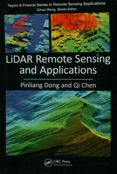
LiDAR remote sensing and applications
The LiDAR data within this book is collected from 27 areas in the United States, Brazil, Canada, Ghana, and Haiti and includes 183 figures created to introduce the concepts, methods, and applications in a clear context. It provides 11 step-by-step projects predominately based on Esri's ArcGIS software to support seamiess integration of LiDAR products and other GIS data. The first six projects …
- Edisi
- -
- ISBN/ISSN
- 978-1-138-74724-1
- Deskripsi Fisik
- 179 hlm. : illus. ; 23,4 cm.
- Judul Seri
- -
- No. Panggil
- 621.3678 PIN l

QGIS map design
- Edisi
- -
- ISBN/ISSN
- 978-0-9985477-4-9
- Deskripsi Fisik
- 209 hlm. : illus.; 30 cm.
- Judul Seri
- -
- No. Panggil
- 910.285 ANI q
- Edisi
- -
- ISBN/ISSN
- 978-0-9985477-4-9
- Deskripsi Fisik
- 209 hlm. : illus.; 30 cm.
- Judul Seri
- -
- No. Panggil
- 910.285 ANI q

Monitoring landslide risk dynamics after a major earquake in a mountainous en…
Major disasters, such as earthquakes, have a large impact on society, causing massive direct and indirect losses. Large earthquakes may also seriously affect the natural environment, in the form of secondary hazards. In mountainous regions one of the most severe secondary effects is the triggering of co seismic landslides. These may results in the loss of vegetation and the production of lar…
- Edisi
- -
- ISBN/ISSN
- 978-90-365-4792-5
- Deskripsi Fisik
- vi, 181 hlm. : illus. ; 24 cm.
- Judul Seri
- -
- No. Panggil
- DS 551.302 CHE m
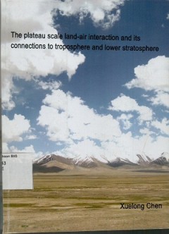
The plateau scale land-air interacton and its connections to troposphere and …
- Edisi
- -
- ISBN/ISSN
- 978-90-61-64-365-4
- Deskripsi Fisik
- viii, 164 hlm. : illus. ; 27 cm.
- Judul Seri
- -
- No. Panggil
- DS 551.43 XUE t
- Edisi
- -
- ISBN/ISSN
- 978-90-61-64-365-4
- Deskripsi Fisik
- viii, 164 hlm. : illus. ; 27 cm.
- Judul Seri
- -
- No. Panggil
- DS 551.43 XUE t
Peraturan menteri negara lingkungan hidup RI no. 09 tahun 2011 tentang pedoma…
- Edisi
- -
- ISBN/ISSN
- -
- Deskripsi Fisik
- 48 hlm.
- Judul Seri
- -
- No. Panggil
- 304.2 BAL p
- Edisi
- -
- ISBN/ISSN
- -
- Deskripsi Fisik
- 48 hlm.
- Judul Seri
- -
- No. Panggil
- 304.2 BAL p
Maluku Utara dalam angka=Maluku Utara in figures 2003
- Edisi
- -
- ISBN/ISSN
- -
- Deskripsi Fisik
- xxx, 294 hlm. : illus.
- Judul Seri
- -
- No. Panggil
- 315.5987 Tha M
- Edisi
- -
- ISBN/ISSN
- -
- Deskripsi Fisik
- xxx, 294 hlm. : illus.
- Judul Seri
- -
- No. Panggil
- 315.5987 Tha M
Programmed learning aid for production and operations management
- Edisi
- -
- ISBN/ISSN
- -
- Deskripsi Fisik
- xi, 208 hlm. illus.
- Judul Seri
- -
- No. Panggil
- 658.5 Elw P
- Edisi
- -
- ISBN/ISSN
- -
- Deskripsi Fisik
- xi, 208 hlm. illus.
- Judul Seri
- -
- No. Panggil
- 658.5 Elw P
 Batas Wilayah
 Ekologi
 Fotogrametri
 Geografi
 Geologi
 GIS
 Ilmu Tanah
 Kartografi
 Manajemen Bencana
 Oceanografi
 Penginderaan Jauh
 Peta