Ditapis dengan

QGIS map design
- Edisi
- -
- ISBN/ISSN
- 978-0-9985477-4-9
- Deskripsi Fisik
- 209 hlm. : illus.; 30 cm.
- Judul Seri
- -
- No. Panggil
- 910.285 ANI q
- Edisi
- -
- ISBN/ISSN
- 978-0-9985477-4-9
- Deskripsi Fisik
- 209 hlm. : illus.; 30 cm.
- Judul Seri
- -
- No. Panggil
- 910.285 ANI q

Public service: tinjauan teoritis dan isu-isu strategis pelayanan public
Atensi pada isu pelayanan publik mencuat seiring rendahnya kepercayaan publik terhadap institusi pemerintahan dan adanya korupsi birokrasi. Pemerintah sebagai penyelenggara pelayanan publik diarahkan adagar dapat memberikan kontribusi yang bermakna atas strategi-upaya pelayanan dalam rangka mewujudkan kesejahteraan rakyat. Komitmen dan kepatuhan terhadap keberlangsungan capaian pelayanan publik…
- Edisi
- -
- ISBN/ISSN
- 978-602-432-611-1
- Deskripsi Fisik
- xvii, 176 hlm. : 23,5 cm.
- Judul Seri
- -
- No. Panggil
- 352.6 CHA p

Manajemen bencana: pengantar dan isu-isu strategis
Bencana sudah menjadi bagian keseharian kita, frekuensinyapun tak terbilang. Isu bencana menjadi magnet publik sekaligus tragedi bagi korban bencana. Meskipun informasi bencana bertebaran, sayangnya di Indonesia masih sedikit buku tentang manajemen kebencanaan secara lengkap, komprehensif dan mengaitkan dengan isu-isu strategis kebencanaan yang melingkupinya. Buku ini beriisi: 1) Konsep, penge…
- Edisi
- -
- ISBN/ISSN
- 978-602-444-507-2
- Deskripsi Fisik
- xxvi, 396 hlm. : 23 cm.
- Judul Seri
- -
- No. Panggil
- 363.3495 WIG m

Georeferencing Menggunakan ArcGIS 10.1
Georefencing merupakan proses pemberian atau menentukan referensi spasial (spatial reference) data raster. Raster yang digunakan berupa citra satelit foto udara, peta digital. Data tersebut beleum mempunyai referensi spasial sehingga perlu dilakukan georeferencing. Setiap raster citra satelit, foto udara, peta hasil scanning, dan peta digital akan mempunyai keterkaitan dalam melakukan georefer…
- Edisi
- -
- ISBN/ISSN
- 978-979-29-292
- Deskripsi Fisik
- viii, 216 hlm. : illus. ; 23.5 cm.
- Judul Seri
- -
- No. Panggil
- 910.0285 SYA g

Mapping the nation: GIS for good governance
- Edisi
- -
- ISBN/ISSN
- 978-1-58948-472-6
- Deskripsi Fisik
- 88 hlm. : illus. ;26 cm.
- Judul Seri
- -
- No. Panggil
- 910.0285 UNI m
- Edisi
- -
- ISBN/ISSN
- 978-1-58948-472-6
- Deskripsi Fisik
- 88 hlm. : illus. ;26 cm.
- Judul Seri
- -
- No. Panggil
- 910.0285 UNI m
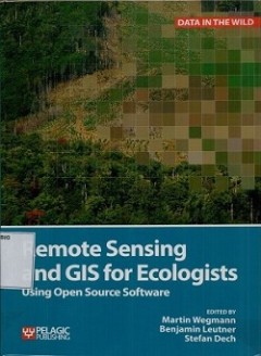
Remote sensing and GIS for ecologists: using open source software
Remote sensing and GIS for ecologists using open source software enables ecologists to integrated remote sensing and GIS in their daily work. It will allow ecologists to get started with the application of remote sensing and to understands its potential and limitations. Using practical examples, the book covers all necessary steps from planning field campaigns to deriving ecologically relevant …
- Edisi
- -
- ISBN/ISSN
- 978-1-78427-022-3
- Deskripsi Fisik
- xviii, 333 hlm. : illus. ; 25 cm
- Judul Seri
- -
- No. Panggil
- 621.3678 MAR r

Getting to know ArcGIS desktop
Update for compatibility with ArcGIS 10, getting to know ArcGIS Desktop introduces principles of geographic information systems (GIS) as it demonstrates the mechanics of using Esri's leading GIS technology. This workbook mcombines key concepts with detailed illustrations and step by step exercises to acquaint readers with the building blocks of ArcGIS Desktop, includingrnArcMap for displaying a…
- Edisi
- -
- ISBN/ISSN
- 978-1-58948-260-9
- Deskripsi Fisik
- xii, 541 hlm Illus
- Judul Seri
- -
- No. Panggil
- 910.285 TIM G

Digital transformations in India cities : between paper list and GIS map
- Edisi
- -
- ISBN/ISSN
- 978-90-365-3654-7
- Deskripsi Fisik
- iv, 277 hlm. : illus. ; 24 cm.
- Judul Seri
- -
- No. Panggil
- DS 910.0285 CHR d
- Edisi
- -
- ISBN/ISSN
- 978-90-365-3654-7
- Deskripsi Fisik
- iv, 277 hlm. : illus. ; 24 cm.
- Judul Seri
- -
- No. Panggil
- DS 910.0285 CHR d

Spatial data modelling for 3D GIS
This book covers fundamental aspects of spatial data modeling specifically on the aspect of three-dimensional(3D) modelling and structuring. Realistation of true 3D GIS spatial system needs a lot of efforts"
- Edisi
- -
- ISBN/ISSN
- 978-3-540-74166-4
- Deskripsi Fisik
- xi, 289 hlm. ; 24 cm.
- Judul Seri
- -
- No. Panggil
- 910.0285 ABD s

GIS research methods:incorporating spatial perspectives
Although this book introduces the underlying theory and applications of GIS, it is not intended as a manual for GIS software. if you are already an experienced GIS user, we hope this book will increase your understanding of the capabilities of GIS and its approaches in your own research applicationts. for those just beginning to use GIS, we designed this book to help you understand how spatial …
- Edisi
- -
- ISBN/ISSN
- 9781589483781
- Deskripsi Fisik
- xvii, 409 hlm, ilius, 24,5 cm
- Judul Seri
- -
- No. Panggil
- 910.285 SHE g
 Batas Wilayah
 Ekologi
 Fotogrametri
 Geografi
 Geologi
 GIS
 Ilmu Tanah
 Kartografi
 Manajemen Bencana
 Oceanografi
 Penginderaan Jauh
 Peta