Ditapis dengan

Mapping the nation :GIS for good governance
This volume, mapping the nation : GIS for good governance, conveys the strong influence of mapping in developing more intelligent policy and propagating leaner, more efficient government. in the less ffity years since GIS revolutinized urban systems, most federal agencies have name come to rely on cartography and geographic analisis to understand the socioeconomic, public safet, and enviromenta…
- Edisi
- -
- ISBN/ISSN
- 9781589484726
- Deskripsi Fisik
- 88 hlm, ilus, 25,5 cm,
- Judul Seri
- -
- No. Panggil
- 910.285 UNI m
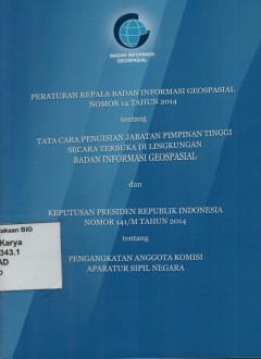
Peraturan Kepala Badan Informasi Geospasial Nomor 14 Tahun 2014 tentang Tata …
Maksud disusunnya Tata Cara Pengisian JAbatan PimpinanTimggi Secara Terbuka di lingkungan Badan Informasi Geospasial adalah sebagai pedoman BAdan Informasi Geospasial dalam penyelenggaraan pegisian jabatan pimpinan tinggi utama, madya dan pejabat calon pejabat pimpinan tinggi utama madya dan pratama secara ternuka. Tujuan nya adalah terselenggaranya seleksi calon pejabat pimpinan tinggi utama, …
- Edisi
- -
- ISBN/ISSN
- -
- Deskripsi Fisik
- 10 hlm. ; 20 cm.
- Judul Seri
- -
- No. Panggil
- Buku.Karya.HK 2019/343.1 BAD p
Internet GIS: distributed geographic information services for the internet an…
Internet GIS addresses a suite of emerging new technologies aimed at making GIS moe mobile, powerful, and flexible, as well as better able to share and communicate geographic information. This groundbreaking book is the first of its kind to troroughly cover basic internet GIS issues such as state of the art technology, implementation practices, applications, and data, as well as future trends …
- Edisi
- -
- ISBN/ISSN
- 0-471-35923-8
- Deskripsi Fisik
- xxxvi, 679 hlm. ; illus. ; 24 cm.
- Judul Seri
- -
- No. Panggil
- HK 910.0285 ZHO i

GIS for the urban environment
The book include twelve chapter thqt intoduce the elements and issues involved in using GIS, and it does so with a widw range of useful naps and illustrations. Each chapter in part provides readers with a carefully chosen set of further readings, along with written exercises, and in partt III, laboratory exercises. Students and practitioners will enjoy working through the individual chapters an…
- Edisi
- -
- ISBN/ISSN
- 978-1-58948-082-7
- Deskripsi Fisik
- xv, 596 hlm. : illus.
- Judul Seri
- -
- No. Panggil
- 307.760285 JUL g
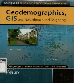
Geodemographics, GIS and neighbourhood targeting
This book provides an introduction to the methods, theoriess and classification techniques that form the foundation of neighboyrhood analysis and commercial geodemographic products. It examines best practice when using geodemodemographic metods, software and systems, to balance academic theories with the realities of the business world. Theory is presented in a user-friendly style and is suppor…
- Edisi
- -
- ISBN/ISSN
- -
- Deskripsi Fisik
- xiv, 293 hlm. illus.
- Judul Seri
- -
- No. Panggil
- 304.603 RIC g
Gis fundamentals :A first text on geographic information systems
This book provides an introduction to the theory and application of GIS. it is written for us in an introductory GIS class and as a reference for the GIS practitioner. this fifth edition blances theoretical and applied material, so that students my apply knowledge of GIS in the solution of real-world problems. improvemets over the previous editions are include an each chapter. topics treated in…
- Edisi
- -
- ISBN/ISSN
- 9781506695877
- Deskripsi Fisik
- xiv, 769 hlm, ilius, 25,5 cm
- Judul Seri
- -
- No. Panggil
- 910.285 PAU g
Pulau Morotai sumberdaya strategis di kawasan Timur Indonesia
Buku dengan judul Pulau Morotai: sumberdaya strategis di Kawasan Timur Indonesia ini merupakan bagian dari komitmen Bakosurtanal dalam memetakan sumber daya alam pulua-pulau terdepan secara sistematis. Pulau Morotai memiliki nilai strategis baik ditinjau dari posisi maupun sumber daya yang sangat besar perannannya bagi pengembangan wilayah. Selain memiliki potensi sumberdaya melimpah, pulau te…
- Edisi
- -
- ISBN/ISSN
- 978-979-1266-79-6
- Deskripsi Fisik
- viii, 144 hlm. : illus.
- Judul Seri
- -
- No. Panggil
- Buku.Karya 2011/18 BAD p

Python for ArcGIS
This book is aimedprimarily at teaching GIS Phyton scripting to GIS users who have little or no Python programming experience. Topicsareorganized to build upon each other, so forthis audience, reading the chapters sequentially is recommended. Computer programmers who are not familiarwith ArcGIS can also use this book to learn toautomated GIS analyses with the ArcGIS Phyton API, accessible thro…
- Edisi
- -
- ISBN/ISSN
- 978-3-319-18397-8
- Deskripsi Fisik
- xvi, 538 hlm. : illus. ;23 cm.
- Judul Seri
- -
- No. Panggil
- 910.0285 LAU p
Sains dan teknologi dalam Islam: tinjauan genetis dan ekologis
- Edisi
- -
- ISBN/ISSN
- 978-979-769-494-4
- Deskripsi Fisik
- viii, 198 hlm.
- Judul Seri
- -
- No. Panggil
- 297.265 Has S
- Edisi
- -
- ISBN/ISSN
- 978-979-769-494-4
- Deskripsi Fisik
- viii, 198 hlm.
- Judul Seri
- -
- No. Panggil
- 297.265 Has S
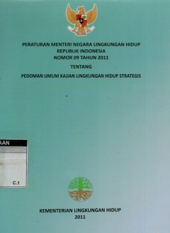
Peraturan menteri negara lingkungan hidup RI no. 09 tahun 2011 tentang pedoma…
- Edisi
- -
- ISBN/ISSN
- -
- Deskripsi Fisik
- 48 hlm.
- Judul Seri
- -
- No. Panggil
- 304.2 BAL p
- Edisi
- -
- ISBN/ISSN
- -
- Deskripsi Fisik
- 48 hlm.
- Judul Seri
- -
- No. Panggil
- 304.2 BAL p
 Batas Wilayah
 Ekologi
 Fotogrametri
 Geografi
 Geologi
 GIS
 Ilmu Tanah
 Kartografi
 Manajemen Bencana
 Oceanografi
 Penginderaan Jauh
 Peta