Ditapis dengan

Penginderaan jauh untuk pengisian GAP data liputan lahan dan tata guna lahan
- Edisi
- -
- ISBN/ISSN
- -
- Deskripsi Fisik
- ii,16 hlm. illus. 28 cm.
- Judul Seri
- -
- No. Panggil
- Buku.Karya 1983/01 Bad p
- Edisi
- -
- ISBN/ISSN
- -
- Deskripsi Fisik
- ii,16 hlm. illus. 28 cm.
- Judul Seri
- -
- No. Panggil
- Buku.Karya 1983/01 Bad p
GIS tutor 2: the quick refence guide
- Edisi
- -
- ISBN/ISSN
- 0-582-223810-2
- Deskripsi Fisik
- 105 hlm. illus.
- Judul Seri
- -
- No. Panggil
- 910.285 JON g
- Edisi
- -
- ISBN/ISSN
- 0-582-223810-2
- Deskripsi Fisik
- 105 hlm. illus.
- Judul Seri
- -
- No. Panggil
- 910.285 JON g

An open-source, QGIS-based solution for digital geological mapping: GEOL-QMAPS
Digital geological mapping has experienced significant growth over the past three decades due to the advent of commercial geographical information systems, advances in global positioning systems, and the availability of portable hand-held devices, such as mobile personal computers (PCs), smartphones, and tablets. Numerous software packages have been developed to collect, combine, organise, visu…
- Edisi
- Vol.24, December 2024
- ISBN/ISSN
- 2590-1974
- Deskripsi Fisik
- 12 hlm PDF, 11.716 KB
- Judul Seri
- Applied Computing and Geoscience - Open Access
- No. Panggil
- 551.136
PixelSWAT: A user-friendly ArcGIS tool for preparing inputs to run SWAT in a …
This paper documents the development of PixelSWAT, a Graphical User interface (GUI) python toolbox developed with the motive of creating gridded watershed and stream features to run the Soil and Water Assessment Tool (SWAT) in a distributed discretization scheme thus allowing optimum utilization of gridded weather datasets. Additionally, the tool also aims to automate the preparation of SWAT we…
- Edisi
- Vol.23, September 2024
- ISBN/ISSN
- 2590-1974
- Deskripsi Fisik
- 17 hlm PDF, 20.155 KB
- Judul Seri
- Applied Computing and Geoscience - Open Access
- No. Panggil
- 551.136
Flood susceptibility mapping: Integrating machine learning and GIS for enhanc…
Flooding presents a formidable challenge in the United States, endangering lives and causing substantial economic damage, averaging around $5 billion annually. Addressing this issue and improving community resilience is imperative. This project employed machine learning techniques and publicly available data to explore the factors influencing flooding and to develop flood susceptibility maps at…
- Edisi
- Vol.23, September 2024
- ISBN/ISSN
- 2590-1974
- Deskripsi Fisik
- 13 hlm PDF, 13.528 KB
- Judul Seri
- Applied Computing and Geoscience - Open Access
- No. Panggil
- 551.136

Point cloud registration for LiDAR and photogrammetric data: A critical synth…
Three-dimensional (3D) point cloud registration is a fundamental step for many 3D modeling and mapping applications. Existing approaches are highly disparate in the data source, scene complexity, and application, therefore the current practices in various point cloud registration tasks are still ad-hoc processes. Recent advances in computer vision and deep learning have shown promising performa…
- Edisi
- Vol.8, April 2023
- ISBN/ISSN
- 1872-8235
- Deskripsi Fisik
- 13 hlm PDF, 8.236 KB
- Judul Seri
- ISPRS Open Journal of Photogrammetry and Remote Sensing
- No. Panggil
- 621.3678
Point cloud registration for LiDAR and photogrammetric data: A critical synth…
Three-dimensional (3D) point cloud registration is a fundamental step for many 3D modeling and mapping applications. Existing approaches are highly disparate in the data source, scene complexity, and application, therefore the current practices in various point cloud registration tasks are still ad-hoc processes. Recent advances in computer vision and deep learning have shown promising performa…
- Edisi
- Vol.8, April 2023
- ISBN/ISSN
- 1872-8235
- Deskripsi Fisik
- 13 hlm PDF, 8,236 KB
- Judul Seri
- ISPRS Open Journal of Photogrammetry and Remote Sensing
- No. Panggil
- 621.3678
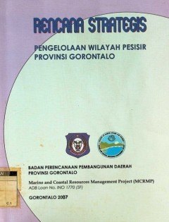
Rencana strategis: pengelolaan wilayah pesisir Propinsi Gorontalo
- Edisi
- -
- ISBN/ISSN
- -
- Deskripsi Fisik
- xiv, 82 hlm. : illus.
- Judul Seri
- -
- No. Panggil
- 333.9164 Fad R
- Edisi
- -
- ISBN/ISSN
- -
- Deskripsi Fisik
- xiv, 82 hlm. : illus.
- Judul Seri
- -
- No. Panggil
- 333.9164 Fad R
Efficient coarse registration method using translation- and rotation-invarian…
In this paper, we present a simple, efficient, and robust algorithm for 2D coarse registration of two point clouds. In the proposed algorithm, the locations of some distinct objects are detected from the point cloud data, and a rotation- and translation-invariant feature descriptor vector is computed for each of the detected objects based on the relative locations of the neighboring objects. Su…
- Edisi
- Vol.2, December 2021
- ISBN/ISSN
- 1872-8235
- Deskripsi Fisik
- 16 hlm PDF, 4.155 KB
- Judul Seri
- ISPRS Open Journal of Photogrammetry and Remote Sensing
- No. Panggil
- 621.3678

GIS for decision support and public policy making
- Edisi
- -
- ISBN/ISSN
- 978-1-58948-231-9
- Deskripsi Fisik
- xiv, 188 hlm. : illus. ; 23 cm.
- Judul Seri
- -
- No. Panggil
- 910.285 CHR g
- Edisi
- -
- ISBN/ISSN
- 978-1-58948-231-9
- Deskripsi Fisik
- xiv, 188 hlm. : illus. ; 23 cm.
- Judul Seri
- -
- No. Panggil
- 910.285 CHR g
 Batas Wilayah
 Ekologi
 Fotogrametri
 Geografi
 Geologi
 GIS
 Ilmu Tanah
 Kartografi
 Manajemen Bencana
 Oceanografi
 Penginderaan Jauh
 Peta