Ditapis dengan

Laporan kegiatan pemodelan geometrik geodinamika di wilayah Indonesia dan Asi…
Kegiatan pemodelan geometrik geodinamika di wilayah Indonesia dan Asia Tenggara ini mempunyai maksud untuk melanjutkan program bidang geodinamika pada tahun-tahun sebelumnya. Kegiatan dimaksud telah dan sedang dilakukan, yang selama ini berdasarkan pengukuran dengan pemanfaatan teknologi Global Positioning System (GPS), untuk mempelajari dan menentukannature and rates pertahun (mm/year) dari pe…
- Edisi
- -
- ISBN/ISSN
- -
- Deskripsi Fisik
- viii, 36 hlm. + lampiran
- Judul Seri
- -
- No. Panggil
- Lap.Kegiatan 2002/58 BAD l
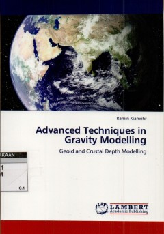
Advanced techniques in gravity modelling
This book try to investigate the procedure fot combining heterogeneous data for medelling of the gravity data. Advanced methods based on the least-squares modification of Stokes’s approach is investigated for local geoid modeling. Inverse gravity modeling for estimation of the crustal depth model is illustrated in details with the numerical case studies. Also, application of satellite altimet…
- Edisi
- -
- ISBN/ISSN
- 978-3-8443-1608-7
- Deskripsi Fisik
- vi, 86 hlm. : illus.
- Judul Seri
- -
- No. Panggil
- 526.1 RAM a
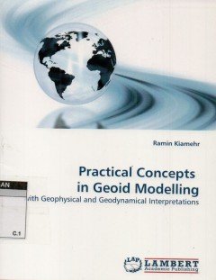
Practical concepts in geoid modelling: with geophysical and geodynamical inte…
Computation of a precise gravimetric geoid model with sparse and limited dat is a difficult task, which needs a special notice. This book investigates the procedure for gathering, evaluating and combining different data for the determination of an optimum gravimetric geoid model as a case study in Iran. It covers the theoretical and practical aspect of geoid modeling and its applications in geo…
- Edisi
- -
- ISBN/ISSN
- 978-3-8383-3310-6
- Deskripsi Fisik
- ix, 203 hlm. : illus.
- Judul Seri
- -
- No. Panggil
- 526.1 RAM p

Gravity, geoid and heigth system: Proceedings of the IAG Symposium GGHS 2012,…
The volume includes a selection of papers presented at the IAG international symposium “Gravity”, Geoid and Height Systems 2012 (GGHS 2012), which was organized by IAG Commission 2 “Gravity Field” with the assistance of the International Gravity Field Service (IGFS) and GGOS Theme 1 Unifield Global Height System: The book summarizes the latest results on gravimetry and gravity network…
- Edisi
- -
- ISBN/ISSN
- 978-3-319-10836-0
- Deskripsi Fisik
- xiii, 346 hlm. : illus.
- Judul Seri
- -
- No. Panggil
- 526.1 URS g

Catatan Inspirasi Geodet Muda : Perjalanan Seorang Mahasiswa Teknik Geodesi
Buku ini berisikan apa saja yang dipelajari di Geodesi, melainkan juga pengalaman apa saja yang bisa di dapat selama menjadi mahasiswa Geodesi. Selain tentang geodesi saya juga sempat menuliskan tenatng biasiswa Bidikmisi, yakni beasiswa yang menyelamatkan hidup saya dan bisa membuat saya bisa menempuh kuliah. Beberapa pengalaman , kejadian pribadi , serta orang=orang yang banyak menginspirasi…
- Edisi
- -
- ISBN/ISSN
- -
- Deskripsi Fisik
- 280 hlm. : illis. ; 15 cm.
- Judul Seri
- -
- No. Panggil
- 153.2 IMA c

Transformation parameters between local levelling datum and geoid:determinati…
The advent of the Global Positioning System (GPS) as a surveying tool has change the tendency for surveyors to depend on local vertical datum for height determation. This is due to the fact that, currently it is possible to determine heights referred to the geoid using GPS and then transform these heights so theat they refer to the local vertical datum and vice versa. This book focuses on deter…
- Edisi
- -
- ISBN/ISSN
- 978-3-8433-8980-8
- Deskripsi Fisik
- xv, 103 hlm. : illus.
- Judul Seri
- -
- No. Panggil
- 526.1 DOR t

Model permukaan dijital: pengolahan data DTM dan DEM dengan perangkat lunak, …
Global Mapper, surfer dan quickGrid adalah bagian dari Model Permukaan Dijital. Ketiga perangkat lunak ini memiliki kemampuan-kemampuan (features) daar Umum yang wajib dimiliki oleh setiap sistem yang sejenis) di dalam menglola data DTM hingga akhirnya menjadi grid dan garis kontur yang siap untuk dianalisis lebih lanjut. Ketiganya sangat praktis & user friendly, meskipun demikian ketiga perang…
- Edisi
- -
- ISBN/ISSN
- 978-979-1153-50-8
- Deskripsi Fisik
- xiv, 537 hlm. illus.
- Judul Seri
- -
- No. Panggil
- 526.1 EDD m
The 1st International Workshop on the Quality of geodesy observation andmonit…
This paper focuseson the modelingof data quality in processes which are in general not knowndetail or which are too complex to describe all influences on data quality. Asemerged during research, artificial neural networks (ANN) are capable formodeling data qualitparameters within processes with respect to their interconnections. Since multi-layer feed forward ANN are required forthis task a la…
- Edisi
- -
- ISBN/ISSN
- 978-3-319-10828-5
- Deskripsi Fisik
- viii, 178 hlm. : illus. ; 29 cm.
- Judul Seri
- -
- No. Panggil
- 526.1 HAN t
GNSS Global Navigation Satellite Systems, GPS, Glonass, Galileo and more
- Edisi
- -
- ISBN/ISSN
- 978-3-211-73012-6
- Deskripsi Fisik
- xxix, 516 hlm. :illus.
- Judul Seri
- -
- No. Panggil
- 526.1 HOF g
- Edisi
- -
- ISBN/ISSN
- 978-3-211-73012-6
- Deskripsi Fisik
- xxix, 516 hlm. :illus.
- Judul Seri
- -
- No. Panggil
- 526.1 HOF g
IUGG chronicle 1989 year book
- Edisi
- -
- ISBN/ISSN
- 0047-1259
- Deskripsi Fisik
- 330 hlm.
- Judul Seri
- -
- No. Panggil
- 526.1 IUG I
- Edisi
- -
- ISBN/ISSN
- 0047-1259
- Deskripsi Fisik
- 330 hlm.
- Judul Seri
- -
- No. Panggil
- 526.1 IUG I
 Batas Wilayah
 Ekologi
 Fotogrametri
 Geografi
 Geologi
 GIS
 Ilmu Tanah
 Kartografi
 Manajemen Bencana
 Oceanografi
 Penginderaan Jauh
 Peta