Ditapis dengan

Metalogeni sundaland vol. II (kumpulan Karya Tulis Ilmiah : Hamdan Zainal Abi…
Buku yang terdiri dari 28 Makalah ini membahas Metalogeni Sundaland Vol. II. Yaitu metalogeni Kalimantan, di antaranya di wilayah prospek Masupa Ria, Prospek Muyup, Cebakan Kelian, daerah Paramasan, Gunung Kukusan, Pegunungan Meratus, Gunungapi Nyaan, Long Pahangai, Pantain BAncah, dan Gunung Miing
- Edisi
- Vol. II
- ISBN/ISSN
- 978-602=9105-50-6
- Deskripsi Fisik
- xvi, 338 hlm. : illus. ; 28 cm.
- Judul Seri
- -
- No. Panggil
- 551 IND m

Geologi dasar
Buku ini merupakan ilmu pengetahuan bumi, mengenai asal, struktur, komposisi dan sejarahnya, serta proses yang menyebabkan keadaan bumi seperti sekarang. Pembahasan pokok dalam ilmu pengetahuan bumi meliputi asal bumi, materi penyusunan bumi, proses yang terjad di bumi, hasil proses dan sejarah bumi. Ilmu ini mempelajri dari benda-benda sekecil atom himgga ukuran benua, samudera , cekungan dan …
- Edisi
- -
- ISBN/ISSN
- 978-602-262-354-0
- Deskripsi Fisik
- xvi, 114 hlm. : illus. ; 25 cm.
- Judul Seri
- -
- No. Panggil
- 551 WAY g

Geologi dinamis
Buku ini terdiri dari Bab 1 : Bumi Sebagai Suatu Planet, membahas tentang planet daratan,bentuk bumi, reliefbumi, asal panasbumi, alran panas dantektonik, komposisi kimiawi bumi, sertamaterial dan susunan kulit bumi. Bab 2 Bumi Sebagai Sistem, membahas tentang sistem geologi, arah perubahan dari sistem geologi,sistem, keseimbangan dan gologi, sistem hidrologi, subsistem pada sistemhidrologi, si…
- Edisi
- -
- ISBN/ISSN
- 978-602-7854-42-0
- Deskripsi Fisik
- vi, 128 hlm. : illus. ; 23 cm.
- Judul Seri
- -
- No. Panggil
- 551 DJA g
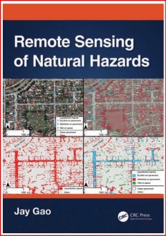
Remote Sensing of Natural Hazards
- Edisi
- -
- ISBN/ISSN
- 9781032406909
- Deskripsi Fisik
- xxv, 437 hlm.; 26 cm.
- Judul Seri
- -
- No. Panggil
- 551.585 GAO r
- Edisi
- -
- ISBN/ISSN
- 9781032406909
- Deskripsi Fisik
- xxv, 437 hlm.; 26 cm.
- Judul Seri
- -
- No. Panggil
- 551.585 GAO r

Longsor Bawah Laut: Kajian Geologi Bawah Permukaan dalam Kerangka Keberlanjutan
- Edisi
- -
- ISBN/ISSN
- 9786340104493
- Deskripsi Fisik
- xvi, 160 hlm.; 23 cm.
- Judul Seri
- -
- No. Panggil
- 551.47 HAR l
- Edisi
- -
- ISBN/ISSN
- 9786340104493
- Deskripsi Fisik
- xvi, 160 hlm.; 23 cm.
- Judul Seri
- -
- No. Panggil
- 551.47 HAR l
An Introduction Into The Geology of Indonesia – Volume 2
- Edisi
- -
- ISBN/ISSN
- 9786232976948
- Deskripsi Fisik
- viii, 670 hlm; 30 cm
- Judul Seri
- -
- No. Panggil
- 551 KOE i
- Edisi
- -
- ISBN/ISSN
- 9786232976948
- Deskripsi Fisik
- viii, 670 hlm; 30 cm
- Judul Seri
- -
- No. Panggil
- 551 KOE i
Geologi Gempa Bumi Indonesia
- Edisi
- -
- ISBN/ISSN
- 9786233592000
- Deskripsi Fisik
- xxviii, 248 hlm; 25 cm
- Judul Seri
- -
- No. Panggil
- 551.225 98 SUB g
- Edisi
- -
- ISBN/ISSN
- 9786233592000
- Deskripsi Fisik
- xxviii, 248 hlm; 25 cm
- Judul Seri
- -
- No. Panggil
- 551.225 98 SUB g

Petrographic Analysis of Mafic and Ultramafic Rocks in Northern Thailand: Imp…
Mafic and ultramafic rocks have become a promising approach for atmospheric carbon dioxide (CO2) reduction, as they are major sources of CO2-reactive minerals, i.e., olivine, pyroxene, plagioclase, and serpentine. The minerals potentially sequester CO2 by turning it into a stable solid phase through carbon mineralization in the rock weathering process. However, detailed descriptions and evaluat…
- Edisi
- Vol.15, Issue 3, March 2025
- ISBN/ISSN
- 2076-3263
- Deskripsi Fisik
- 28 hlm PDF, 12,179 KB
- Judul Seri
- Geosciences
- No. Panggil
- 550

Numerical and Experimental Seismic Characterization of Byblos Site in Lebanon
Geological and topographic site effects lead to variations in the spatial distribution of ground motion during large earthquakes. Despite the impact of such phenomena, they remain poorly understood. There is a lack of joint studies of numerical predictions and experimental observations on the geomorphological site effects. Therefore, a comparison between well-constrained models and experimental…
- Edisi
- Vol.15, Issue 3, March 2025
- ISBN/ISSN
- 2076-3263
- Deskripsi Fisik
- 27 hlm PDF, 3.780 KB
- Judul Seri
- Geosciences
- No. Panggil
- 550

Geophysical-Geotechnical Characterization of Mud Volcanoes in Cartagena Colombia
In this research, the mud diapirism phenomenon in the Membrillal sector in Cartagena is characterized to analyze its spatiotemporal evolution. The goal is to geomorphologically, geotechnically, and geologically characterize the area to zone regions with the greatest susceptibility to geological hazards and provide an updated diagnosis of the phenomenon. This study is conducted due to the risks …
- Edisi
- Vol.15, Issue 3, March 2025
- ISBN/ISSN
- 2076-3263
- Deskripsi Fisik
- 34 hlm PDF, 7.640 KB
- Judul Seri
- Geosciences
- No. Panggil
- 550
 Batas Wilayah
 Ekologi
 Fotogrametri
 Geografi
 Geologi
 GIS
 Ilmu Tanah
 Kartografi
 Manajemen Bencana
 Oceanografi
 Penginderaan Jauh
 Peta