Ditapis dengan

Estimation of tree height from pollinSAR: the effects of vertical structure a…
Height values of trees are an important indicator of the health and viability of forest. At present, it is the main biopysical parameter observable from remote sensing images, in partiocular from Polarimetric Interferometric SAR (PolInSAR) data. It is important to have these values as accurately as possible. The accuracy of estimated tree height obtained by PolInSAR is affected by temporal deco…
- Edisi
- -
- ISBN/ISSN
- 978-90-365-4730-7
- Deskripsi Fisik
- xviii, 131 hlm. : illus. ; 24 cm.
- Judul Seri
- -
- No. Panggil
- 621.3678 NAF e
Earth observation of global change: The role of satellite remote sensing in m…
- Edisi
- -
- ISBN/ISSN
- 978-1-4020-6357-2
- Deskripsi Fisik
- xi, 223 hlm. illus.
- Judul Seri
- -
- No. Panggil
- 621.3678 Emi E
- Edisi
- -
- ISBN/ISSN
- 978-1-4020-6357-2
- Deskripsi Fisik
- xi, 223 hlm. illus.
- Judul Seri
- -
- No. Panggil
- 621.3678 Emi E
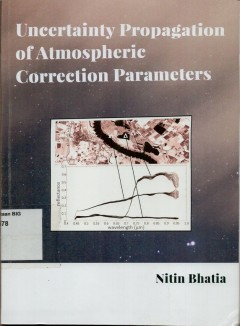
Uncertainty propagation of atmospheric correction parameters
The main objective of this research was to quantify the propagation of uncertainty in a layered processing system as applied in processing and arcgiving facilities. A framework is presented that is suited for the purpose. Practical uncertainty estimates are then obtained by estimating a reflectance product using there parameters: column water vapour, aerosol optical depth, and the adjacency ran…
- Edisi
- -
- ISBN/ISSN
- 978-90-365-4237-1
- Deskripsi Fisik
- xvii, 112 hlm. : illus. ; 24 cm
- Judul Seri
- -
- No. Panggil
- 621.3678 NIT u
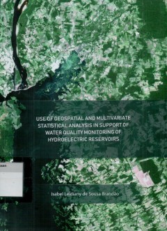
Use of geospatial and multivariate statistical analysis in support of water …
Hydropower reservoirs are man-made artificial aquatic ecosystem that present a high dynamic and cmplexity in space and time, with interactions between iys structural (dams), physical chemical and biological components. They are important not only for their electrical power generation, but also for other functions susch as water suply, flood control, fisheries, as ecological wetland, for leisure…
- Edisi
- -
- ISBN/ISSN
- 978-90-365-4735-2
- Deskripsi Fisik
- xii, 171 hlm.: illus. ; 24 cm.
- Judul Seri
- -
- No. Panggil
- DS 627.8 ISA u
Kumpulan peraturan pelaksanaan otonomi daerah
- Edisi
- Cetakan Pertama
- ISBN/ISSN
- -
- Deskripsi Fisik
- 217 hlm. 26 cm.
- Judul Seri
- -
- No. Panggil
- 348.02 IKA K
- Edisi
- Cetakan Pertama
- ISBN/ISSN
- -
- Deskripsi Fisik
- 217 hlm. 26 cm.
- Judul Seri
- -
- No. Panggil
- 348.02 IKA K

Program induk survai dan pemetaan Nasional dalam Pelita Ketiga (Dok.No. 17/1978)
Kebijaksanaan umum survai dan pemetaan nasional dalam pelita ketiga mencakup pemanfaatan dan pengelolaan berupa kondisi geografi, kekayaan alam dan sumberdaya manusia yang dituangkan dalam program pemetaan, inventarisasi dan evaluasi sumberdaya alam yang diarahkan kepada penyajian informasi bagi perencanaan dan pengelolaan pembangunnan yang selain ditujukan kepada peningkatan ekonomi, juga dida…
- Edisi
- -
- ISBN/ISSN
- -
- Deskripsi Fisik
- 28 hlm.; 28 cm.
- Judul Seri
- -
- No. Panggil
- Dokumen 1978/17 BAD p

Terms of reference for astudy with regard to the establishment of a homogeneo…
- Edisi
- -
- ISBN/ISSN
- -
- Deskripsi Fisik
- -
- Judul Seri
- -
- No. Panggil
- Dokumen 1979/06 BAD t
- Edisi
- -
- ISBN/ISSN
- -
- Deskripsi Fisik
- -
- Judul Seri
- -
- No. Panggil
- Dokumen 1979/06 BAD t

Sistem informasi geodesi (SINDESI): daftar titik-titik kontrol Kalimantan dan…
Dokumen ini berisi koordinat titik-titik kontrol horizontal dan deskripsi letak pilarnya. Titik-titik kontrol dimaksud adalah hasil dari penentuan posisi dengan teknik pengukuran doppler. Sumber data dokumen ini beradadalam database (SINDESI) pada komputer Bakosurtanal yang setiap saat diperlukan dapat dipanggil secara langsung dari terminal komputer dengan fasilitas panggil sbb. : Nomor stasiu…
- Edisi
- -
- ISBN/ISSN
- -
- Deskripsi Fisik
- -
- Judul Seri
- -
- No. Panggil
- 526.1

Mengolah Data Citra Satelit menggunakan ENVI
Pada buku Mengolah Data Citra Satelit Menggunakan ENVI akan menjelaskan proses pengolahan citra dari mulai awal, yaitu pengenalan fungsi-fungsi ENVI, proses mozaik, klasifikasi, sampai pada pemanfaatan ENVI dalam aplikasi terapan. Buku ini disusun secara sistematis sehingga pembaca akan mendapatkan pengertian yang jelas dari setiap proses pengolahan citra dalam buku ini.
- Edisi
- -
- ISBN/ISSN
- 9789792960556
- Deskripsi Fisik
- viii + 208 hlm ; 16 x 23 cm
- Judul Seri
- -
- No. Panggil
- 621.3678 GIO m

Survey and mapping activities in Indonesia during the last decade (Dok.18/1983)
The Project approach is obtain data/information system urgently needed for solving shorter term development needds, at scales ranging from 1:50.000 to 1:10.000 or lanrger. There fore it is primally a sectoral concern, geared towards sectoral needs and in accrdance with sectoral requirements and specifications.
- Edisi
- -
- ISBN/ISSN
- -
- Deskripsi Fisik
- -
- Judul Seri
- -
- No. Panggil
- Dokumen 1983/18 BAD s
 Batas Wilayah
 Ekologi
 Fotogrametri
 Geografi
 Geologi
 GIS
 Ilmu Tanah
 Kartografi
 Manajemen Bencana
 Oceanografi
 Penginderaan Jauh
 Peta