Ditapis dengan

ISPRS Journal of Photogrammetry and Remote Sensing Volume 159 January 2020
1. Wide-area invasive species propagation mapping is possible using phenometric trends p. 1-12 2. Automatic scale estimation of structure from motion based 3D models using laser scalers in underwater scenarios p. 13-25 3. Comparison of multi-seasonal Landsat 8, Sentinel-2 and hyperspectral images for mapping forest alliances in Northern California p 26-40 4. Investigating the resolution capa…
- Edisi
- Volume 159 january 2020
- ISBN/ISSN
- 0924-2716
- Deskripsi Fisik
- 377 hlm. : illus. ; 28 cm.
- Judul Seri
- -
- No. Panggil
- 526.982
ISPRS Journal Photogrammetry and Remote Sensing Volume 162 April 2020
1. Voronoi classified and clustered data constellation: A new 3D data structure for geomarketing strategies p. 1-16 2. Recent ENSO influence on East African drought during rainy seasons through the synergistic use of satellite and reanalysis data p. 17-26 3. Detection of Xylella fastidiosa infection symptoms with airborne multispectral and thermal imagery: Assessing bandset reduction performa…
- Edisi
- Volume 162 April 2020
- ISBN/ISSN
- 0924-2716
- Deskripsi Fisik
- 228 hlm. : illus. ; 28 cm.
- Judul Seri
- -
- No. Panggil
- 526.982
ISPRS Journal of Photogrammetry and Remote Sensing Volume 165 Juli 2020
1. Complete and accurate data correction for seamless mosaicking of airborne hyperspectral images: A case study at a mining site in Inner Mongolia, China p. 1-15 2. A simple and effective method for removing residual reflected skylight in above-water remote sensing reflectance measurements p. 16-27 3. Mapping the condition of macadamia tree crops using multi-spectral UAV and WorldView-3 image…
- Edisi
- Volume 165 July 2020
- ISBN/ISSN
- 0924-2716
- Deskripsi Fisik
- 171 hlm. : illus. ; 28 cm.
- Judul Seri
- -
- No. Panggil
- 526.982
ISPRS Journal of Photogrammetry and Remote Sensing Volume 176 June 2021
1. Self-supervised monocular depth estimation from oblique UAV videos p. 1-14 2. Classifying rock slope materials in photogrammetric point clouds using robust color and geometric features p. 15-29 3. Radiative transfer modeling to measure fire impact and forest engineering resilience at short-term p. 30-41 4. Learning deep cross-scale feature propagation for indoor semantic segmentation …
- Edisi
- Vol. 176 June 2021
- ISBN/ISSN
- 0924-2716
- Deskripsi Fisik
- 274 hlm.: illus.; 28 cm.
- Judul Seri
- -
- No. Panggil
- 526.982
ISPRS Journal of Photogrammetry and Remote Sensing Volume 175 May 2021
1. Center pivot field delineation and mapping: A satellite-driven object-based image analysis approach for national scale accounting p. 1-19 2. Learning deep semantic segmentation network under multiple weakly-supervised constraints for cross-domain remote sensing image semantic segmentation p. 20-33 3. Refinement of interferometric SAR parameters using digital terrain model as an external …
- Edisi
- Vol. 175 May 2021
- ISBN/ISSN
- 0924-2716
- Deskripsi Fisik
- 460 hlm. illus.; 28 cm.
- Judul Seri
- -
- No. Panggil
- 526.982
ISPRS Journal of Photogrammetry and Remote Sensing Volume 174 April 2021
1. A CNN approach to simultaneously count plants and detect plantation-rows from UAV imagery p. 1-17 2. Automated street tree inventory using mobile LiDAR point clouds based on Hough transform and active contours p. 19-34 3. A hybrid global structure from motion method for synchronously estimating global rotations and global translations p. 35-55 4. Using a fully polarimetric SAR to detec…
- Edisi
- Vol. 174 April 2021
- ISBN/ISSN
- 0924-2716
- Deskripsi Fisik
- 303 hlm.: illus.; 28 cm.
- Judul Seri
- -
- No. Panggil
- 526.982
Penelitian Hyperspektral untuk pemetaan keanekaragaman hayati
Data MODIS (Moderate Resolution Imaging Spectroradiometer) tersedia dengan bebas dengan keunggulan dalam resolusi temporal. Dalam penelitian ini, data bulanan MODIS-EVI (Enhanced Vegatation Index) digunakan untuk melihat tren perubahan, serta pengaruh musim dan variabilitas iklim terhadap indeks vegetasi dengan menunggunakan data MODIS-EVI dari tahun 2000 sampai 2009. Dari hasil spatial trend a…
- Edisi
- -
- ISBN/ISSN
- 978-979-26-6966-4
- Deskripsi Fisik
- vi, 69 hlm ; ill ; 25 cm
- Judul Seri
- -
- No. Panggil
- Buku.Karya 2023/491.02 IBN p
Kapabilitas ALOS, TerraSAR-X dan Cartosat sebagai sumber data alternatif peme…
DEM adalah tampilan dari permukaan bumi secara 3 dimensi. Dapat diperoleh menggunakan teknik otomatis dengan foto udara yang overlap. Indian remote sensing satellite cartosat-1 diluncurkan pada tanggal 5 mei 2005. Cartosat-1 mempunyai kemampuan untuk memperoleh citra stereo secara real time sepanjang jalur dengan resolusi spasial 2,5 m. Data stereo dari satelit ini bersama dengan Rational Polyn…
- Edisi
- -
- ISBN/ISSN
- 978-979-26-6962-6
- Deskripsi Fisik
- vi, 57 hlm , ; ill ; 25 cm
- Judul Seri
- -
- No. Panggil
- Buku.Karya 2023/495.02 ADE k

Penginderaan jauh terapan
Buku ini berisikan tentang pengertian teori dan praktek penginderaan jauh melalu serangkaian studi-studi kasus, masing-masing dipilih secara teliti untuk menunjukkan pendekatan tipikal di bawah batasan data yang ada. Hal ini dapat menghasilkan evaluasi yang mendalam m,engenai berbagai teknik dalam enarik data lingkungan baik metrik maupun environmental. Setelah peninjauan luas terhadap jenis-j…
- Edisi
- -
- ISBN/ISSN
- 979-456-156-8
- Deskripsi Fisik
- xi 475 hlm. 25cm.
- Judul Seri
- -
- No. Panggil
- 621.3678 CP P
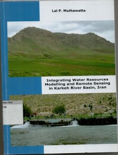
Integrating water resources modelling and remote sensing in Karkheh river bas…
- Edisi
- -
- ISBN/ISSN
- 978-90-365-3794-0
- Deskripsi Fisik
- xiv, 151 hlm. : illus. ; 27 cm.
- Judul Seri
- -
- No. Panggil
- DS 621.3678 LAL i
- Edisi
- -
- ISBN/ISSN
- 978-90-365-3794-0
- Deskripsi Fisik
- xiv, 151 hlm. : illus. ; 27 cm.
- Judul Seri
- -
- No. Panggil
- DS 621.3678 LAL i
 Batas Wilayah
 Ekologi
 Fotogrametri
 Geografi
 Geologi
 GIS
 Ilmu Tanah
 Kartografi
 Manajemen Bencana
 Oceanografi
 Penginderaan Jauh
 Peta