Ditapis dengan

Mapping spatial variation of foliar nitrogen using hyperspectral remote sensing
The thesis aimed to retriever foliar nitrogen at the leaf and canopy level using radiative transfer models and with hyperspectral remote sensing. The research in this thesis firstly evaluated the feasibility of retrieving nitrogen by inversion of aleaf radiative transfer model PROSPECT. The indirect estimation of nitrogen by inversion of leaf PROSPECT through links between model and the empiri…
- Edisi
- -
- ISBN/ISSN
- 978-90-365-4209-8
- Deskripsi Fisik
- vi, 166 hlm. : illus. ; 24 cm.
- Judul Seri
- -
- No. Panggil
- DS 621.3678 ZHI m
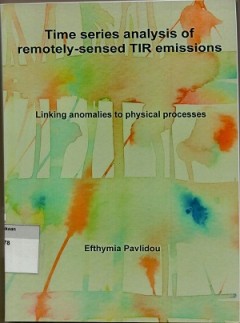
Time series analysis of remotely sensed TIR emissions: linking anomalies to p…
This thesis describes the application of time series analysis to satellite derived thermal infrared imagery, in order to determine if spatiotemporally limited anomalies can be linked to earthquake occurrence as has been suggested by literature. For this pupose, a methodology is applied that can sppress large scale patterns and highligt subbtle localized fluctuations in hypertemporal satellite …
- Edisi
- -
- ISBN/ISSN
- 978-90365-4624-9
- Deskripsi Fisik
- v, 143 hlm. : illus. ; 24 cm.
- Judul Seri
- -
- No. Panggil
- DS 621.3678 EFT t

Remote sensing and modelling of snow processes
This thesis aims to improve snow processes simulations by land surface models (LSM). The LSM simulated snow processes define energy and water fluxes over the snow covered land surface for the numerical weather prediction models. Therefore, the improvements in snow processes simulation are expected to impact positively the weather and stream flow forecasts. The research described in this thesi…
- Edisi
- -
- ISBN/ISSN
- 978-90-365-3751-3
- Deskripsi Fisik
- xii,133 hlm, illus , 23 cm
- Judul Seri
- -
- No. Panggil
- DS 621.3678 MUH r

Studi fenomena perubahan muka air laut menggunakan data satelit altimetri JAS…
Salah satu dampak dari perubahan iklim global adalah perubahan muka air laut. Kenaikan muka air laut didefinisikan sebagai peningkatan volume air laut yang disebabkan oleh beberapa faktor seperti fluktuasi curah hujan yang tinggi serta meningkatnya suhu air laut. Perubahan muka air laut dalam waktu yang cukup lama dengan nilai oerubahan yang tinggi dapat memberi dampak yang destruktif pada popu…
- Edisi
- -
- ISBN/ISSN
- -
- Deskripsi Fisik
- xx, 129 hlm. : illus. ; 21 cm.
- Judul Seri
- -
- No. Panggil
- 621.3678 CRI s

Pengaruh kerentanan lingkungan terhadap produktivitas padi berbasis teknologi…
Ketahanan pangan dipengaruhi oleh beberapa faktor yaitu ketersediaan pangan, aspek pangan, pemanfaatan pangan dan kerentanan pangan. Aspek yang dapat mempengaruhi kerentanan pangan adalah penurunan produktivitas pangan, salah satu satunya adalah tanaman padi yang merupakan pangan pokok di Indonesia. Penyebab penurunan produktivitas padi adalah kondisi kerentanan lingkungan satu wilayah,. Tujua…
- Edisi
- -
- ISBN/ISSN
- -
- Deskripsi Fisik
- iv, 105 hlm. : illus, ; 29 cm.
- Judul Seri
- -
- No. Panggil
- 621.3678 RAH p
Quantifying the role of microphytobenthos in temperate intertidal ecosystems …
This thesis aimed to quantify the functional and structuring role of MPB on estuarine tidal flats in the estuarine ecosystem. A genetic method was developed to retrieve MPB primary production rates from a combination of remotely sensed information, that allows the assessment of MPB on the estuary scale, ambient temperature measurements, field measurements of photosynthetic parameters and a tid…
- Edisi
- -
- ISBN/ISSN
- 978-90-365-5124-3
- Deskripsi Fisik
- iii, 202 hlm. : illus. ; 24 cm.
- Judul Seri
- -
- No. Panggil
- 621.3678 TIS q
Remotely sensing the species of individual trees
This Thesis aimed to accurately map the species of individual trees using multi source remotely sensed data, including aerial photographs, airbone LiDAR and hyperspectral data. The Research in the thesis firstly evaluated the performance of geometric and radiometric metrics from airbone LiDAR data under leaf on and leaft off conditions for individual tree species discrimination. The results em…
- Edisi
- -
- ISBN/ISSN
- 978-90-365-4953-0
- Deskripsi Fisik
- viii, 149 hlm. : illus. ; 24 cm
- Judul Seri
- -
- No. Panggil
- DS 621.3678 YIF r
Remote sensing image classification in R
This book offers an introduction to remotely sensed image processing and classification in R using machine learning algorithms. It also provides a concise and practical refence tutorial, which equips readers to immediately start using the software platform and R packages for image processing and classification. This book is divided into five chapter. Chapter 1, introduces remote sensing digi…
- Edisi
- -
- ISBN/ISSN
- 978-981-13-8011-2
- Deskripsi Fisik
- xvii, 189 hlm. : illus. ; 24 cm.
- Judul Seri
- -
- No. Panggil
- 621.3678 COU r

LiDAR remote sensing and applications
The LiDAR data within this book is collected from 27 areas in the United States, Brazil, Canada, Ghana, and Haiti and includes 183 figures created to introduce the concepts, methods, and applications in a clear context. It provides 11 step-by-step projects predominately based on Esri's ArcGIS software to support seamiess integration of LiDAR products and other GIS data. The first six projects …
- Edisi
- -
- ISBN/ISSN
- 978-1-138-74724-1
- Deskripsi Fisik
- 179 hlm. : illus. ; 23,4 cm.
- Judul Seri
- -
- No. Panggil
- 621.3678 PIN l
Automating image-based cadastral boundary mapping
- Edisi
- -
- ISBN/ISSN
- 978-90-365-4874-8
- Deskripsi Fisik
- xiv, 189 hlm. : illus. : 24 cm.
- Judul Seri
- -
- No. Panggil
- DS 621.3678 SOP a
- Edisi
- -
- ISBN/ISSN
- 978-90-365-4874-8
- Deskripsi Fisik
- xiv, 189 hlm. : illus. : 24 cm.
- Judul Seri
- -
- No. Panggil
- DS 621.3678 SOP a
 Batas Wilayah
 Ekologi
 Fotogrametri
 Geografi
 Geologi
 GIS
 Ilmu Tanah
 Kartografi
 Manajemen Bencana
 Oceanografi
 Penginderaan Jauh
 Peta