Ditapis dengan

Pengembangan aplikasi sistem informasi geografis: berbasis desktop dan Web
Akhir-akhir ini kebutuhan akan informasi peta dalam berbagai bidang semakin dirasakan. Hal ini dikarenakan peta merupakan suatu komoditas informasi visual yang sangat representatif. Banyak hal dapat diinformasikan peta dan tidak dengan teks. Seiring perkembangan teknologi informasi dan komunikasi, peta dapat diolah dan disajikan secara dinamis dalam bentuk aplikasi SIG (Sistem Informasi Geogra…
- Edisi
- -
- ISBN/ISSN
- 978-602-5568-44-2
- Deskripsi Fisik
- xvi, 412 hlm. : 23 cm.
- Judul Seri
- -
- No. Panggil
- 910.0285 RIY p

Georeferencing Menggunakan ArcGIS 10.1
Georefencing merupakan proses pemberian atau menentukan referensi spasial (spatial reference) data raster. Raster yang digunakan berupa citra satelit foto udara, peta digital. Data tersebut beleum mempunyai referensi spasial sehingga perlu dilakukan georeferencing. Setiap raster citra satelit, foto udara, peta hasil scanning, dan peta digital akan mempunyai keterkaitan dalam melakukan georefer…
- Edisi
- -
- ISBN/ISSN
- 978-979-29-292
- Deskripsi Fisik
- viii, 216 hlm. : illus. ; 23.5 cm.
- Judul Seri
- -
- No. Panggil
- 910.0285 SYA g
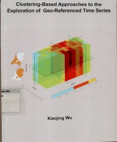
Clustering based approaches to the exploration of geo-referenced time series
- Edisi
- -
- ISBN/ISSN
- 978-90-365-4161-9
- Deskripsi Fisik
- x, 129 cm. : illus. ; 24 cm.
- Judul Seri
- -
- No. Panggil
- DS 910.285 XIA c
- Edisi
- -
- ISBN/ISSN
- 978-90-365-4161-9
- Deskripsi Fisik
- x, 129 cm. : illus. ; 24 cm.
- Judul Seri
- -
- No. Panggil
- DS 910.285 XIA c

Getting to know ArcGIS desktop
Update for compatibility with ArcGIS 10, getting to know ArcGIS Desktop introduces principles of geographic information systems (GIS) as it demonstrates the mechanics of using Esri's leading GIS technology. This workbook mcombines key concepts with detailed illustrations and step by step exercises to acquaint readers with the building blocks of ArcGIS Desktop, includingrnArcMap for displaying a…
- Edisi
- -
- ISBN/ISSN
- 978-1-58948-260-9
- Deskripsi Fisik
- xii, 541 hlm Illus
- Judul Seri
- -
- No. Panggil
- 910.285 TIM G
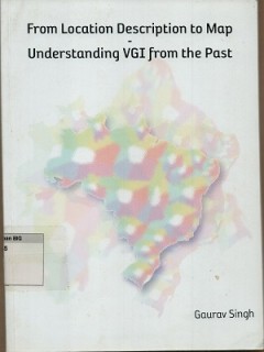
From location description to map understading VGI from the past
- Edisi
- -
- ISBN/ISSN
- 978-90-365-3683-7
- Deskripsi Fisik
- xi, 144 hlm. : illus. ; 27 cm.
- Judul Seri
- -
- No. Panggil
- DS 910.285 GAU f
- Edisi
- -
- ISBN/ISSN
- 978-90-365-3683-7
- Deskripsi Fisik
- xi, 144 hlm. : illus. ; 27 cm.
- Judul Seri
- -
- No. Panggil
- DS 910.285 GAU f
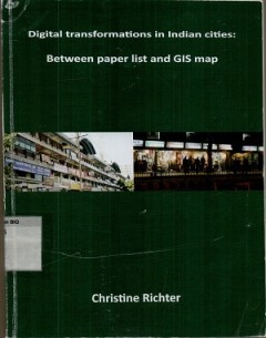
Digital transformations in India cities : between paper list and GIS map
- Edisi
- -
- ISBN/ISSN
- 978-90-365-3654-7
- Deskripsi Fisik
- iv, 277 hlm. : illus. ; 24 cm.
- Judul Seri
- -
- No. Panggil
- DS 910.0285 CHR d
- Edisi
- -
- ISBN/ISSN
- 978-90-365-3654-7
- Deskripsi Fisik
- iv, 277 hlm. : illus. ; 24 cm.
- Judul Seri
- -
- No. Panggil
- DS 910.0285 CHR d
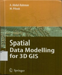
Spatial data modelling for 3D GIS
This book covers fundamental aspects of spatial data modeling specifically on the aspect of three-dimensional(3D) modelling and structuring. Realistation of true 3D GIS spatial system needs a lot of efforts"
- Edisi
- -
- ISBN/ISSN
- 978-3-540-74166-4
- Deskripsi Fisik
- xi, 289 hlm. ; 24 cm.
- Judul Seri
- -
- No. Panggil
- 910.0285 ABD s

Geostatistical and geospatial approaches for the characterization of natural …
These proceeding of the LAMG 2014 conference in new delhi explore the current state of the art and inform readers about the latest geostatistical and space-based tehcnologies for assessment and manajement in the contexts of natural resource exploration, enviromental pollution, hazards and natural disaster research. the proceeding cover 3D visuallization, time-series analysis, enviromental geoch…
- Edisi
- -
- ISBN/ISSN
- 978-3-319-18662-7
- Deskripsi Fisik
- xxiv, 969 hlm, ilus, 24 cm
- Judul Seri
- -
- No. Panggil
- 910.0285 JAN g

GIS research methods:incorporating spatial perspectives
Although this book introduces the underlying theory and applications of GIS, it is not intended as a manual for GIS software. if you are already an experienced GIS user, we hope this book will increase your understanding of the capabilities of GIS and its approaches in your own research applicationts. for those just beginning to use GIS, we designed this book to help you understand how spatial …
- Edisi
- -
- ISBN/ISSN
- 9781589483781
- Deskripsi Fisik
- xvii, 409 hlm, ilius, 24,5 cm
- Judul Seri
- -
- No. Panggil
- 910.285 SHE g
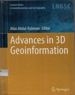
Advances in 3D geoinformation
The book presents a collection of accepted papers from the 3D Geoinfo 2015 international conference brought together poineering international researchers and practitioners to facilitate the dialogue on emerging topics in the field of 3D geo-information. the focus areas include:rn-Data collection and modelling : advanced approaches for 3D data collection, reconstructions and methods for represen…
- Edisi
- -
- ISBN/ISSN
- 9783319256894
- Deskripsi Fisik
- vii, 512 hlm, ilus, 24 cm
- Judul Seri
- -
- No. Panggil
- 910.285 ALI a
 Batas Wilayah
 Ekologi
 Fotogrametri
 Geografi
 Geologi
 GIS
 Ilmu Tanah
 Kartografi
 Manajemen Bencana
 Oceanografi
 Penginderaan Jauh
 Peta