Ditapis dengan
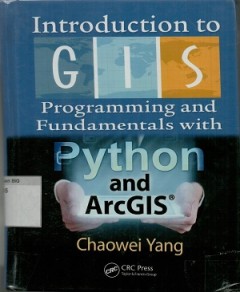
Introduction to GIS programming and fundamentals with Phyton and Arcgis
This textbook covers a remarkable breadth of material, from the practical nuts-and-bolts of programming a GIS, to the fundamental concepts that underpin all of spatial information science. as spatial computing skills become increasingly valued both in education and the workplace, a book like this is an invaluable resource for people who want to understand more about and do more with spatial dat…
- Edisi
- -
- ISBN/ISSN
- 9781466510081
- Deskripsi Fisik
- xix, 302 hlm, ilius, 24 cm
- Judul Seri
- -
- No. Panggil
- 910.285 CHA i

SISTEM INFORMASI GEOGRAFIS, konsep dan implementasi disertai contoh kasus ana…
Sistem informasi geografis (SIG) bukanlah tekhnologi baru dalam ilmu dunia komputer. andalannya dalam menganalisis suatu masalah secara spasial telah menarik minat sebagian besar untuk memimplementasikan teknologi ini dalam berbagai bidang. muatan buku ini lebih diperkaya dengan sejarah kemunculan SIG, Pemahaman komprehensip data spasial, fungsi analisis spasial hingga pemahaman konsep teknolog…
- Edisi
- -
- ISBN/ISSN
- 9786026324061
- Deskripsi Fisik
- xviii, 178 hlm, 25 cm
- Judul Seri
- -
- No. Panggil
- 910.0285 MUH s

Tutorial lengkap menguasai Arcgis 10
- Edisi
- -
- ISBN/ISSN
- 9789792960075
- Deskripsi Fisik
- xii, 212 hlm, 23 cm, illus
- Judul Seri
- -
- No. Panggil
- 910.0285 WAH t
- Edisi
- -
- ISBN/ISSN
- 9789792960075
- Deskripsi Fisik
- xii, 212 hlm, 23 cm, illus
- Judul Seri
- -
- No. Panggil
- 910.0285 WAH t
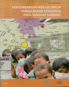
Pengembangan Web GIS untuk pengelolaan pengungsi pada tanggap darurat
Bencana alam semakin banyak terjadi di Indonesia. Satu hal yang penting adalah penanganan pengungsi yang memerlukan kerjasama yang terintegrasi antar pihak terkait. Beberapa contoh kurang efektif dalam penanganan pengungsi adalah tidak terdatanya dan tersampaikannya kebutuhan mendesak pengungsi dan penyebaran bantuan yang tidak merata. Untuk itu diperlukan suatu sistem informasi spasial untuk m…
- Edisi
- -
- ISBN/ISSN
- 978-602-9439-12-0
- Deskripsi Fisik
- vii, 31 hlm. : illus.
- Judul Seri
- -
- No. Panggil
- Buku.Karya 2011/16 BAD p
3D geoinformation science: the selected of the papers 3D geoinfo 2014
Nowadays 3D Geoinformation is needede for many planning and analysis tasks. For example, 3D city and infrastructure models are paying the for complex environmental and noice analyzes. 3D geological sub-surface models are needed for reservoir exploration in the oil-gas-and geothermal industry. Thus 3D Geoinformation brings together researchers and practitioners fr9om different fields such as the…
- Edisi
- -
- ISBN/ISSN
- 978-3-110-12180-2
- Deskripsi Fisik
- vi, 258 hlm. : illus. ; 24 cm.
- Judul Seri
- -
- No. Panggil
- 910.0285 MAR t
Geospatial techniques in urban planning
- Edisi
- -
- ISBN/ISSN
- 978-3-642-13558-3
- Deskripsi Fisik
- xiii, 393 hlm. : illus. ; 29 cm.
- Judul Seri
- -
- No. Panggil
- 910.0285 ZHE g
- Edisi
- -
- ISBN/ISSN
- 978-3-642-13558-3
- Deskripsi Fisik
- xiii, 393 hlm. : illus. ; 29 cm.
- Judul Seri
- -
- No. Panggil
- 910.0285 ZHE g

Geospatial technology and the role of location in science
- Edisi
- -
- ISBN/ISSN
- 978-90-481-2719-4
- Deskripsi Fisik
- xiii, 321 hlm. : illus. ; 29 cm.
- Judul Seri
- -
- No. Panggil
- 910.0285 HEN g
- Edisi
- -
- ISBN/ISSN
- 978-90-481-2719-4
- Deskripsi Fisik
- xiii, 321 hlm. : illus. ; 29 cm.
- Judul Seri
- -
- No. Panggil
- 910.0285 HEN g

Advances in geo-spatial information science
- Edisi
- -
- ISBN/ISSN
- 978-0-415-62093-2
- Deskripsi Fisik
- xiii, 285 hlm. : illus.
- Judul Seri
- -
- No. Panggil
- 910.285 Wen A
- Edisi
- -
- ISBN/ISSN
- 978-0-415-62093-2
- Deskripsi Fisik
- xiii, 285 hlm. : illus.
- Judul Seri
- -
- No. Panggil
- 910.285 Wen A

Resistor theory and technology
- Edisi
- -
- ISBN/ISSN
- -
- Deskripsi Fisik
- 308 hlm.
- Judul Seri
- -
- No. Panggil
- 621.384133 Fel R
- Edisi
- -
- ISBN/ISSN
- -
- Deskripsi Fisik
- 308 hlm.
- Judul Seri
- -
- No. Panggil
- 621.384133 Fel R

Mapping the nation :GIS for good governance
This volume, mapping the nation : GIS for good governance, conveys the strong influence of mapping in developing more intelligent policy and propagating leaner, more efficient government. in the less ffity years since GIS revolutinized urban systems, most federal agencies have name come to rely on cartography and geographic analisis to understand the socioeconomic, public safet, and enviromenta…
- Edisi
- -
- ISBN/ISSN
- 9781589484726
- Deskripsi Fisik
- 88 hlm, ilus, 25,5 cm,
- Judul Seri
- -
- No. Panggil
- 910.285 UNI m
 Batas Wilayah
 Ekologi
 Fotogrametri
 Geografi
 Geologi
 GIS
 Ilmu Tanah
 Kartografi
 Manajemen Bencana
 Oceanografi
 Penginderaan Jauh
 Peta