Ditapis dengan
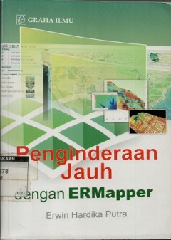
Penginderaan jauh dan interpretasi citra
ERMapper merupakan salah satu software pengolah citra penginderaan jauh yang mumpuni untuk diterapkan dalm bidang pengelolaan sumberdaya alam. Berbagai teknik pengolahanncitra dari yang dasar hingga lanjutan dapat dilakukan menggunakan software ini. ERMapper memberikan kemudahan dalam pengoperasian, kompatibilitas terhadap software SIG (Sistem Informasi Geografis), mendukung berbagai format dat…
- Edisi
- -
- ISBN/ISSN
- 978-979-756-705-7
- Deskripsi Fisik
- x, 286 hlm. : illus.
- Judul Seri
- -
- No. Panggil
- 621.3678 THO p

Remote sensing of Wetlands : applications and advances
Since this book focuses on advances in remote sensing technology to perfprm such inventories, a brief overview of wetlands seems warranted. This chapter is intended to provide that introduction and includes a list of references for readers to gain a more complete understanding of wetlands.
- Edisi
- -
- ISBN/ISSN
- 978-1-4822-3735-1
- Deskripsi Fisik
- xvii, 555 hlm. : illus. ; 26 cm.
- Judul Seri
- -
- No. Panggil
- 621.3678 RAL r

Principles of applied remote sensing
This book is one of the firt to explain the fundamentals and applications of remote sensing at both undesgradiuate and graduate levels. Topics include definitions and a brief history of payloads and platforms, data acquisition and specifications, image processing techniques, data integration and spatial modeling, and a renge of applications covering terrestrial, atmosperic, oceanographic and p…
- Edisi
- -
- ISBN/ISSN
- 978-3-319-22559-3
- Deskripsi Fisik
- xii, 307 hlm. : illus. ; 24 cm.
- Judul Seri
- -
- No. Panggil
- 621.3678 SIA p

GNSS remote sensing: theory, methods and applications
The versatile and available GNSS signals can detect the Earth's surface environments as a new. highly precise, continuous, all-weather and near-real-time remote sensing tool. This book present the theory and methods of GNSS remote sening as well as its applications in the atmosphere, ocean, land and hydrology. Groud-based atmospheric sensing, space-borne aqtmospheric sensing, reflectometrry, o…
- Edisi
- -
- ISBN/ISSN
- 978-94-007-7482-7
- Deskripsi Fisik
- xvi, 276 hlm. : illus. ; 24 cm.
- Judul Seri
- Remote sensing and digital image processing
- No. Panggil
- 621.3678 SHU g

High spatial resolution remote sensing: data, analysis and applications
- Edisi
- -
- ISBN/ISSN
- 978-1-4987-6768-2
- Deskripsi Fisik
- 375 hlm. : illus. ; 24 cm.
- Judul Seri
- -
- No. Panggil
- 621.3678 YUH h
- Edisi
- -
- ISBN/ISSN
- 978-1-4987-6768-2
- Deskripsi Fisik
- 375 hlm. : illus. ; 24 cm.
- Judul Seri
- -
- No. Panggil
- 621.3678 YUH h

Remote sensing and image interpretation
The front cover a topographic image derived for airborne lidar data, two days affer the massive Oso landslide (March 2014, in Washington State). With more than forty deaths and nearly fiffy homes destroyed, this event ranks among the deadliest kandslides in U.S. history. Lidar (light detection and ranging, Chapter 6) is an active remote sensing technique that ivolves transmitting pulses of l…
- Edisi
- -
- ISBN/ISSN
- 0-471-85462-x
- Deskripsi Fisik
- 721 hlm. ilus.
- Judul Seri
- -
- No. Panggil
- 621.3678 THO r
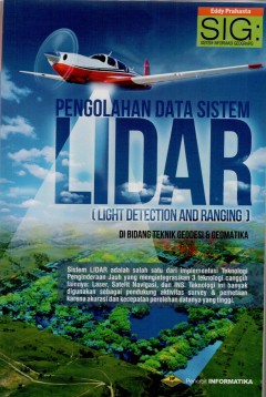
Pengolahan data sistem LIDAR (Light Detection and Ranging) di bidang teknik g…
Detil permukaan bumi berubah denga cepat masih pada saat pembuatan petanya, dan peta tersebut blm memenuhi standard belum cukup memenuhi kebutuhn data spasial detil & terkini. Untungnya tersedia sistem Lidar yang dapat digunakan untuk menukur ketinggian muka bumi, berikut gambatan mengenai unsur-unsur vegetasi & kanopinya secara detil, instan,menyeluruh, dan menghasilkan data yang rapat tanpa…
- Edisi
- -
- ISBN/ISSN
- 978-6021514-85-8
- Deskripsi Fisik
- xxviii,596 hlm.: illus. ;23 cm.
- Judul Seri
- -
- No. Panggil
- 621.3678 EDD p

Teori dan praktek penginderaan jauh
Buku ini memaparkan konsep fundamental tentang Penginderaan Jauh (PJ) atau Remote Sensing (RS), sekaligus tutorial pengolahan citra satelit dan satelite. Dan buku ini memberikan bekal pengetahuan teoritis tentang penginderaan jauh kepada masyarakat di Indonesia, utamannya bagi mahasiswa S1dari semuabidangilmu yang menggunakan teknologi atau teknik PJ.. PJ merupakan teknologi/teknik untuk menguk…
- Edisi
- -
- ISBN/ISSN
- 978-979-29-4224-8
- Deskripsi Fisik
- xviii, 294 hlm. : illus.
- Judul Seri
- -
- No. Panggil
- 621.3678 IND t
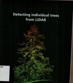
Detecting individual trees from LIDAR
- Edisi
- -
- ISBN/ISSN
- 978-90-365-4396-5
- Deskripsi Fisik
- viii, 139 hlm. : illus. ;24 cm.
- Judul Seri
- -
- No. Panggil
- 621.3678 ANA d
- Edisi
- -
- ISBN/ISSN
- 978-90-365-4396-5
- Deskripsi Fisik
- viii, 139 hlm. : illus. ;24 cm.
- Judul Seri
- -
- No. Panggil
- 621.3678 ANA d

Estimation of tree height from pollinSAR: the effects of vertical structure a…
Height values of trees are an important indicator of the health and viability of forest. At present, it is the main biopysical parameter observable from remote sensing images, in partiocular from Polarimetric Interferometric SAR (PolInSAR) data. It is important to have these values as accurately as possible. The accuracy of estimated tree height obtained by PolInSAR is affected by temporal deco…
- Edisi
- -
- ISBN/ISSN
- 978-90-365-4730-7
- Deskripsi Fisik
- xviii, 131 hlm. : illus. ; 24 cm.
- Judul Seri
- -
- No. Panggil
- 621.3678 NAF e
 Batas Wilayah
 Ekologi
 Fotogrametri
 Geografi
 Geologi
 GIS
 Ilmu Tanah
 Kartografi
 Manajemen Bencana
 Oceanografi
 Penginderaan Jauh
 Peta