Ditapis dengan

Open source geospatial tools : application in earth observation
Our book focuses on the use of open source software for geospatial analysis, provides concise solutions for analyzing and visualizing spatial data, and demonstratesbthe effectiveness of the command line interface for handling geospatial. data processing and clearly explain how it should be used. Finally, a hands on guide to the phyton and C++aplication programming interfaces of GDAL/OGR is pro…
- Edisi
- -
- ISBN/ISSN
- 978-3-319-01823-2
- Deskripsi Fisik
- xxv, 358 hlm. : illus. ; 22 cm.
- Judul Seri
- -
- No. Panggil
- 910.0285 DAN o

Geospatial semantic web
This book covers key issues related to Geospatial Semantic Web, including geospatial web services for spatial data interoperability, geospatial ontology for semantic interoperability, ontology creation, sharing, and integration, querying knowledge and information from heterrogeneous data source, interfaces for Geospatial Semantic Web, VGI (Volunteered Geographic Information) and Geospatial Sema…
- Edisi
- -
- ISBN/ISSN
- 978-3-319-17801-1
- Deskripsi Fisik
- vii, 194 hlm : illus, ; 24 cm
- Judul Seri
- -
- No. Panggil
- 910.0285 CHU g

Sistem informasi geografis: membangun aplikasi web based GIS dengan map server
Seiring dengan hadirnya teknologi internet, SIG pun tumbuh lebih cepat dan beradaptasi lebih jauh. Ia bisa dimunculkan atau dipublikasikan melaluui jaringan internet dan atau intranet.rnMapserver adalah ssalah satu tool (program aplikasi CGI) yang dapat digunakan untuk membangun aplikasi web-basedGIS.rnBuku ini menjelaskan penggunaan MapServer, tahap demi tahap, dari awal hingga ke bagian akhir…
- Edisi
- -
- ISBN/ISSN
- 979-3338-92-x
- Deskripsi Fisik
- vii, 265 hlm. : illus.
- Judul Seri
- -
- No. Panggil
- 910.285 EDD s
Sistem Informasi Geografis dengan Quantum GIS
Antarmuka Quantum GIS sudah sangat ramah pengguna terutama bagi yang telah terbiasa dengan berbagai software GIS lainnnya. fasilitas menu dan tool-tool cukup lengkap untuk berbagai pemerosesan dasar peta digital hingga beberapa aplikasinya yang lebih luas seperti geoprocesing , analisis geometrik dan sebagainya. Bagi pembaca yang telah familiar dengan quantum GIS versi sebelumnya akan menemui …
- Edisi
- -
- ISBN/ISSN
- 9789792953183
- Deskripsi Fisik
- xx, 252 hlm,ilus, 23cm
- Judul Seri
- -
- No. Panggil
- 910.0285 EKO s

Keamanan Sistem Informasi
Dalam buku ini juga diberikan masukan atau gambaran apa saja yang harus diperhatikan apabila bermaksud untuk membuat atau mereview kebijakan sekuriti sistem informasi.rnAdapun langkah-langkah yang dapat dipertimbangkan pada saat penyusunan kebijakan sekuriti sistem informasi yang dibahas dalam buku ini, meliputi:rn• Mengidentifikasi semua aset dan resources yang penting di organisasi. Tujuan …
- Edisi
- Ed. 1
- ISBN/ISSN
- 978-979-29-1792-5
- Deskripsi Fisik
- xii, 180 hlm. : illus., 23 cm.
- Judul Seri
- -
- No. Panggil
- 005.3 IBI k
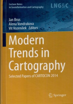
Modern trends in cartography: selected papers of CARTOCON 2014
The book content consists of four parts. The first part New Approaches ini Map and atlas making, collect studies about innovative ways in map production and atlases compilation, following part of the book Prodress in web cartography brings examples and tools for web pap presentation. The third part Advanced mrthod in map use includes achievement of eye-tracking research and users issues, Thebfi…
- Edisi
- -
- ISBN/ISSN
- 978-3-319-07925-7
- Deskripsi Fisik
- xxiii, 534 hlm. : illus. 23 cm.
- Judul Seri
- -
- No. Panggil
- 910.0285 JAN m
Open street map in GIScience: experience research and application
This book global deing to promore the project's integration. The respective chapter address : state-of -the-art and cutting-edge approaches to data quaoity analysis in Open St4reetMap. b. Investigations on understanding Open StreetMap contributors and the nature of their contributions, c. Identifying pattern of contributions and contributors, d. Applications of Open StreetMap in different domai…
- Edisi
- -
- ISBN/ISSN
- 978-3-319-14279-1
- Deskripsi Fisik
- xi, 324 hlm. : illus.
- Judul Seri
- -
- No. Panggil
- 910.285 JAM o
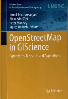
OpenStreetMap in GIScience
- Edisi
- -
- ISBN/ISSN
- 978-3319-14279-1
- Deskripsi Fisik
- xi, 324 hlm. : illus. ; 24 cm.
- Judul Seri
- -
- No. Panggil
- 910.0285 JAM o
- Edisi
- -
- ISBN/ISSN
- 978-3319-14279-1
- Deskripsi Fisik
- xi, 324 hlm. : illus. ; 24 cm.
- Judul Seri
- -
- No. Panggil
- 910.0285 JAM o

Multicriteria decision analysis in geoinformation science
The book is intended for the GIS Science and Decision Science communities. It is primarily targeted at postgraduate students and practitioners in GIS and urban, regional and environmental planning as well as applied decision analysis. It is also suitable for those studying and working with spatial decision support systems. The main objectives of this book are to effectively integrate Multicrite…
- Edisi
- -
- ISBN/ISSN
- 978-3-540-64756-7
- Deskripsi Fisik
- xv,331 hlm. : illus. ; 24cm.
- Judul Seri
- -
- No. Panggil
- 910.0285 JAC m
Disaster response GIS for public safety
- Edisi
- -
- ISBN/ISSN
- 1-879102-88-9
- Deskripsi Fisik
- 108 hlm.
- Judul Seri
- -
- No. Panggil
- 910.0285 GAR d
- Edisi
- -
- ISBN/ISSN
- 1-879102-88-9
- Deskripsi Fisik
- 108 hlm.
- Judul Seri
- -
- No. Panggil
- 910.0285 GAR d
 Batas Wilayah
 Ekologi
 Fotogrametri
 Geografi
 Geologi
 GIS
 Ilmu Tanah
 Kartografi
 Manajemen Bencana
 Oceanografi
 Penginderaan Jauh
 Peta