Ditapis dengan
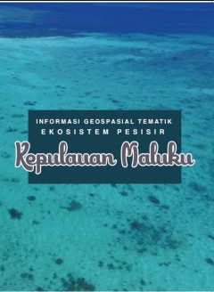
Informasi geospasial tematik ekosistem pesisir Kepulauan Maluku
Kepulauan Maluku merupakan gugusan pulau di bagian timur Nusantara yang memiliki sumberdaya alam melimpah dan beragam. Provinsi Maluku Utara terkenal sebagai penghasil rempah-rempah sehingga dikenal dengan sebutan "Spice Island". Kekayaan pesisir dan laut Kepulauan Maluku sangat besar. Terumbu karang, lamun dan mangrove sebagian besar masih dalam kondisi yang baik. Perairan Maluku masuk dalam …
- Edisi
- -
- ISBN/ISSN
- 978-602-6641-37-3
- Deskripsi Fisik
- iii, 105 hlm. : 26,5 cm.
- Judul Seri
- -
- No. Panggil
- Buku.Karya 2020/380.2 YON i

Memotret Indonesia dari udara
Badan Informasi Geospasial (BIG) memiliki tugas pokok untuk menyediakan peta dasar, salah satunya Peta Rupabumi Indonesia (Peta RBI) untuk seluruh wilayah Indonesia. unit eselon II yang diberi kewenangan untuk menyediakan Peta RBI adalah Pusat Pemetaan Rupabumi dan Toponim (PPRT). Peta RBI yang dihasilkan melingkupi beberapa skala peta, mulai dari skala kecil (1:1.000.000, 1:500.000 dan 1:250.…
- Edisi
- -
- ISBN/ISSN
- 978-602-6641-30-4
- Deskripsi Fisik
- vi, 56 hlm. : illus. ; 26,5 cm.
- Judul Seri
- -
- No. Panggil
- Buku.Karya 2020/381.2 ELI m

Gazeter Republik Indonesia Edisi 1 Tahun 2022 Unsur Rupabumi Pulau
- Edisi
- -
- ISBN/ISSN
- 978-602-6641-74-8
- Deskripsi Fisik
- xi, 1210 hlm. : 21 cm.
- Judul Seri
- -
- No. Panggil
- Buku.Karya 2022/529.09 BAD g
- Edisi
- -
- ISBN/ISSN
- 978-602-6641-74-8
- Deskripsi Fisik
- xi, 1210 hlm. : 21 cm.
- Judul Seri
- -
- No. Panggil
- Buku.Karya 2022/529.09 BAD g

Toponim pariwisata
Istilah toponim (nama rupabumi) mungkin terdengar asng di telinga sebagian besar masyarakat Indonesia. Padahal toponim berada sangat dekat dengan kehidupan kita sehari-hari. Toponim dapat dimaknai secara sederhana sebagai nama tempat beserta informasi lokasinya. Bila kita memakai peta navigasi baik daring ataupun luring, maka itulah contoh pemanfaatan yang nyata dari toponim. Melalui toponim, a…
- Edisi
- -
- ISBN/ISSN
- 978-602-6641-34-2
- Deskripsi Fisik
- x, 48 hlm. : illus. ; 26,5 cm.
- Judul Seri
- -
- No. Panggil
- Buku.Karya 2020/384 WAH t

Geoscience language models and their intrinsic evaluation
Geoscientists use observations and descriptions of the rock record to study the origins and history of our planet, which has resulted in a vast volume of scientific literature. Recent progress in natural language processing (NLP) has the potential to parse through and extract knowledge from unstructured text, but there has, so far, been only limited work on the concepts and vocabularies that ar…
- Edisi
- Vol.14, June 2022
- ISBN/ISSN
- -
- Deskripsi Fisik
- 10 hlm PDF, 1.163 KB
- Judul Seri
- Applied Computing and Geoscience - Open Access
- No. Panggil
- 551.136
Evolution of the stress and strain field in the tyra field during the Post-Ch…
When hydrocarbon reservoirs are used as a CO2 storage facility, an accurate uncertainty analysis and risk assessment is essential. An integration of information from geological knowledge, geological modelling, well log data, and geophysical data provides the basis for this analysis. Modelling the time development of stress/strain changes in the overburden provides prior knowledge about fault an…
- Edisi
- Vol.14, June 2022
- ISBN/ISSN
- 2590-1974
- Deskripsi Fisik
- 13 hlm PDF, 15,111 KB
- Judul Seri
- Applied Computing and Geoscience - Open Access
- No. Panggil
- 551.136
Estimating the seven transformational parameters between two geodetic datums …
This study evaluates the steepest descent algorithm as a tool for root mean square (RMS) error optimization in geodetic reference systems to improve the integrity of transformation. With an initial RMS error estimate of 0.01830m, the negative gradient direction was applied through the steepest optimization leading to a final RMS error estimate of 0.00051m. Using the exact line search mode with …
- Edisi
- Vol.14, June 2022
- ISBN/ISSN
- 2590-1974
- Deskripsi Fisik
- 11 hlm PDF, 4.653 KB
- Judul Seri
- Applied Computing and Geoscience - Open Access
- No. Panggil
- 551.136
Interactive web mapping tools and custom subsurface cross-sections for interd…
Using Python-based geospatial analytics, open-source web mapping technologies, geophysical data models, and subsurface stratigraphy models from the Regional Geology Geologic Framework Model database assembled by Los Alamos National Laboratory, we developed a suite of web-based geologic investigation tools to identify and understand subsurface structures and geophysical properties concerning sal…
- Edisi
- Vol.13, March 2022
- ISBN/ISSN
- 2590-1974
- Deskripsi Fisik
- 9 hlm PDF, 12.176 KB
- Judul Seri
- Applied Computing and Geoscience - Open Access
- No. Panggil
- 551.136
Geotechnical soil mapping from electrical and mechanical properties: Case stu…
Preliminary work in civil engineering works often involves the investigation of soil support in order to secure or predict project safety. The objective of this work is to purpose an urban geotechnical soil map combining physical and mechanical behaviour of the soil and its electrical properties. Field work with auger corer allowed collection of samples for analysis. The results of the Atterber…
- Edisi
- Vol.13, March 2022
- ISBN/ISSN
- 2590-1974
- Deskripsi Fisik
- 16 hlm PDF, 30.776 KB
- Judul Seri
- Applied Computing and Geoscience - Open Access
- No. Panggil
- 551.136
A model of fluid expulsion from compacting tight sedimentary rocks based on t…
Expulsion of fluids from tight rocks is an important process in sedimentary basins for phenomena such as distribution of overpressure and primary migration of hydrocarbons. This paper shows that the “Toggle Switch” (TS) algorithm of Miller and Nur is well-suited to model expulsion of brine by hydraulic fracturing from tight rocks undergoing compaction. Local random overpressure is generated…
- Edisi
- Vol.13, March 2022
- ISBN/ISSN
- 2590-1974
- Deskripsi Fisik
- 9 hlm PDF, 5.145 KB
- Judul Seri
- Applied Computing and Geoscience - Open Access
- No. Panggil
- 551.136
 Batas Wilayah
 Ekologi
 Fotogrametri
 Geografi
 Geologi
 GIS
 Ilmu Tanah
 Kartografi
 Manajemen Bencana
 Oceanografi
 Penginderaan Jauh
 Peta