Ditapis dengan

Human Geography: Issues for 21st century
- Edisi
- -
- ISBN/ISSN
- 0 58236799 9
- Deskripsi Fisik
- -
- Judul Seri
- -
- No. Panggil
- 304.2 PET h
- Edisi
- -
- ISBN/ISSN
- 0 58236799 9
- Deskripsi Fisik
- -
- Judul Seri
- -
- No. Panggil
- 304.2 PET h
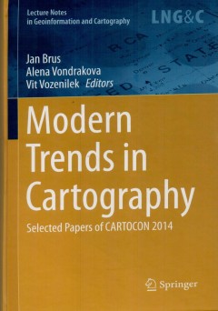
Modern trends in cartography: selected papers of CARTOCON 2014
The book content consists of four parts. The first part New Approaches ini Map and atlas making, collect studies about innovative ways in map production and atlases compilation, following part of the book Prodress in web cartography brings examples and tools for web pap presentation. The third part Advanced mrthod in map use includes achievement of eye-tracking research and users issues, Thebfi…
- Edisi
- -
- ISBN/ISSN
- 978-3-319-07925-7
- Deskripsi Fisik
- xxiii, 534 hlm. : illus. 23 cm.
- Judul Seri
- -
- No. Panggil
- 910.0285 JAN m
Open street map in GIScience: experience research and application
This book global deing to promore the project's integration. The respective chapter address : state-of -the-art and cutting-edge approaches to data quaoity analysis in Open St4reetMap. b. Investigations on understanding Open StreetMap contributors and the nature of their contributions, c. Identifying pattern of contributions and contributors, d. Applications of Open StreetMap in different domai…
- Edisi
- -
- ISBN/ISSN
- 978-3-319-14279-1
- Deskripsi Fisik
- xi, 324 hlm. : illus.
- Judul Seri
- -
- No. Panggil
- 910.285 JAM o
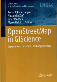
OpenStreetMap in GIScience
- Edisi
- -
- ISBN/ISSN
- 978-3319-14279-1
- Deskripsi Fisik
- xi, 324 hlm. : illus. ; 24 cm.
- Judul Seri
- -
- No. Panggil
- 910.0285 JAM o
- Edisi
- -
- ISBN/ISSN
- 978-3319-14279-1
- Deskripsi Fisik
- xi, 324 hlm. : illus. ; 24 cm.
- Judul Seri
- -
- No. Panggil
- 910.0285 JAM o
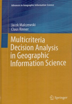
Multicriteria decision analysis in geoinformation science
The book is intended for the GIS Science and Decision Science communities. It is primarily targeted at postgraduate students and practitioners in GIS and urban, regional and environmental planning as well as applied decision analysis. It is also suitable for those studying and working with spatial decision support systems. The main objectives of this book are to effectively integrate Multicrite…
- Edisi
- -
- ISBN/ISSN
- 978-3-540-64756-7
- Deskripsi Fisik
- xv,331 hlm. : illus. ; 24cm.
- Judul Seri
- -
- No. Panggil
- 910.0285 JAC m
Disaster response GIS for public safety
- Edisi
- -
- ISBN/ISSN
- 1-879102-88-9
- Deskripsi Fisik
- 108 hlm.
- Judul Seri
- -
- No. Panggil
- 910.0285 GAR d
- Edisi
- -
- ISBN/ISSN
- 1-879102-88-9
- Deskripsi Fisik
- 108 hlm.
- Judul Seri
- -
- No. Panggil
- 910.0285 GAR d

Monitoring and modeling of global changes : a geomatics perspective
This book will motivate theundergraduate and graduate students, reseachers and practitioners to butter understand the environmental changes with informed solutions. Global Change studies are increasingly considered a vital source of information to understand the Earth Environment, especially in the framework of human induced, climate change and land use transformation. Satellite Earth Observi…
- Edisi
- -
- ISBN/ISSN
- 978-94-017-9813-6
- Deskripsi Fisik
- xi, 320 hlm. : illus. ; 24 cm.
- Judul Seri
- -
- No. Panggil
- 910.0285 JON m
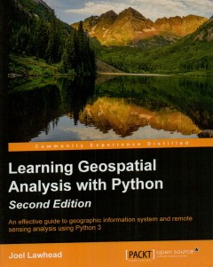
Learning geospatial analysis with phyton : an effective guide GIS and RS anal…
This book focuses on pure Python whenever posible to minimiza compling platform-dependent binaries, so that you don't become bogged down in preparing for analysis. This boox will complete your technicql library through handy recipes, shat will give you a good understanding of a fiel that supplements many modern day human endeavors
- Edisi
- -
- ISBN/ISSN
- 978-1-78355-242-9
- Deskripsi Fisik
- xiii, 367 hlm. : iluus. ; 24 cm.
- Judul Seri
- -
- No. Panggil
- 910.0285 JOE l
Mengenal Nusantara : Provinsi Sumatera Utara
- Edisi
- -
- ISBN/ISSN
- 979-755-744-8
- Deskripsi Fisik
- x, 320 hlm. : illus. ; 25 cm.
- Judul Seri
- -
- No. Panggil
- 910 STE m
- Edisi
- -
- ISBN/ISSN
- 979-755-744-8
- Deskripsi Fisik
- x, 320 hlm. : illus. ; 25 cm.
- Judul Seri
- -
- No. Panggil
- 910 STE m
Sistem informasi geografis:konsep-konsep dasar (perspektif geodesi dan geomat…
Karena kebutuhan yang bersifat komprehensif, adalah tidak mudah untuk memisahkan aspek spasial dengan propertiesnya. Demikian pula dengan aplikasi yang mengelolalnya. Kecenderungannya adalah aplikasi yang dapat mengelola basisdata spasial juga dapat menangani basisdata atribut. Sebagai contoh, perangkat SIG dapat membaca, memanggil, dan memanipulasi basisdata spasial yang disimpan di dalam D…
- Edisi
- -
- ISBN/ISSN
- 978-602-1514-61-0
- Deskripsi Fisik
- xxxii, 760 hlm. : illus. ; 24 cm.
- Judul Seri
- -
- No. Panggil
- 910.0285 EDD s
 Batas Wilayah
 Ekologi
 Fotogrametri
 Geografi
 Geologi
 GIS
 Ilmu Tanah
 Kartografi
 Manajemen Bencana
 Oceanografi
 Penginderaan Jauh
 Peta