Ditapis dengan
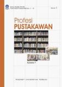
Profesi pustakawan menghadapi tantangan perubahan
Profesi pustakawan mulai tumbuh pada akhir abad ke 19 dalam sejarah perkembangannya profesi ini mendapat kritikan tajam dari para sosiologi yang meneliti masalah profesi. Sejumlah sosiologi meragukan pustakawan sebagai profesi. Bahkan ada yang berpendapat bahwabpustakawan tidak akan menjadi profesi penuh. Benarkah demikian? Kinni profesi pustakawan telah diakui sebagai profesi penuh. Lebih dar…
- Edisi
- -
- ISBN/ISSN
- 978-602-262-006-8
- Deskripsi Fisik
- xiv, 182 hlm
- Judul Seri
- -
- No. Panggil
- 023.2 PUR p

ISPRS Journal of Photogrammetry and Remote Sensing Vol.155 September 2019
1. A tentative test for measuring the sub-millimeter settlement and uplift of a high-speed railway bridge using COSMO-SkyMed images p. 1-12 2. A robust method for reconstructing global MODIS EVI time series on the Google Earth Engine p. 13-24 3. Lever-arm and boresight correction, and field of view determination of a spectroradiometer mounted on an unmanned aircraft system p. 25-36 4. HPM-TD…
- Edisi
- Vol.155 September 2019
- ISBN/ISSN
- 0924 - 2716
- Deskripsi Fisik
- 205 hlm.; ilus 28cm
- Judul Seri
- -
- No. Panggil
- 526.982
Atlas nasional Indonesia: Vol. 1, Fisik dan lingkungan alam
- Edisi
- -
- ISBN/ISSN
- -
- Deskripsi Fisik
- 14 hlm. illus.
- Judul Seri
- -
- No. Panggil
- 912 TRI a
- Edisi
- -
- ISBN/ISSN
- -
- Deskripsi Fisik
- 14 hlm. illus.
- Judul Seri
- -
- No. Panggil
- 912 TRI a

Atlas du development regional du togo
- Edisi
- -
- ISBN/ISSN
- -
- Deskripsi Fisik
- 207 hlm. : Illus. ; 33cm.
- Judul Seri
- -
- No. Panggil
- 912 ADD a
- Edisi
- -
- ISBN/ISSN
- -
- Deskripsi Fisik
- 207 hlm. : Illus. ; 33cm.
- Judul Seri
- -
- No. Panggil
- 912 ADD a

The National atlas of Korea: for children
The National ATlas of Korea contains geographic information on the land, environment, economy, people, culture and history of Korea. As a national rcord, the National Atlas of Korea is an official reference for the world that not only defines and explains Korea's terotory and territorial water, but also introduces Korea to other nations. It is also an effective way to introduces the dynamic cha…
- Edisi
- -
- ISBN/ISSN
- 978-89-93841-27-5
- Deskripsi Fisik
- 107 hlm. : illus. ; 35 cm
- Judul Seri
- -
- No. Panggil
- 912 CHO t

The National atlas of Korea: comprehensive edition
- Edisi
- -
- ISBN/ISSN
- -
- Deskripsi Fisik
- 171 hlm. : illus. ; 42 cm
- Judul Seri
- -
- No. Panggil
- 912 COE a
- Edisi
- -
- ISBN/ISSN
- -
- Deskripsi Fisik
- 171 hlm. : illus. ; 42 cm
- Judul Seri
- -
- No. Panggil
- 912 COE a
ISPRS Journal of Photogrammetry and Remote Sensing Vol.154 August 2019
1. Pixel size of aerial imagery constrains the applications of unmanned aerial vehicle in crop breeding p. 1-9 2. Generation of long-term InSAR ground displacement time-series through a novel multi-sensor data merging technique: The case study of the Shanghai coastal area p. 10-27 3. LAM: Locality affine-invariant feature matching p. 28-40 4. Automatic extraction of accurate 3D tie points fo…
- Edisi
- Vol.154 August 2019
- ISBN/ISSN
- 0924 - 2716
- Deskripsi Fisik
- 271 hlm.; ilus 28cm
- Judul Seri
- -
- No. Panggil
- 526.982
ISPRS Journal of Photogrammetry and Remote Sensing Vol.153 July 2019
1. Reliable image matching via photometric and geometric constraints structured by Delaunay triangulation p. 1-20 2. Illumination-Robust remote sensing image matching based on oriented self-similarity p. 21-35 3. Developing a new cross-sensor calibration model for DMSP-OLS and Suomi-NPP VIIRS night-light imageries p. 36-47 4. Social sensing from street-level imagery: A case study in learning…
- Edisi
- Vol.153 July 2019
- ISBN/ISSN
- 0924 - 2716
- Deskripsi Fisik
- 165 hlm.; ilus 28cm
- Judul Seri
- -
- No. Panggil
- 526.982
ISPRS Journal of Photogrammetry and Remote Sensing Vol.152 June 2019
1. Spatial, temporal, and spectral variations in albedo due to vegetation changes in China’s grasslands p. 1-12 2. An improved algorithm for estimating the Secchi disk depth from remote sensing data based on the new underwater visibility theory p. 13-23 3. Characterization and modeling of power line corridor elements from LiDAR point clouds p. 24-33 4. Remote sensing image fusion via compr…
- Edisi
- Vol.152 June 2019
- ISBN/ISSN
- 0924 - 2716
- Deskripsi Fisik
- 210 hlm.; ilus 28cm
- Judul Seri
- -
- No. Panggil
- 526.982
ISPRS Journal of Photogrammetry and Remote Sensing Vol.150 April 2019
1. Design and evaluation of a full-wave surface and bottom-detection algorithm for LiDAR bathymetry of very shallow waters p. 1-10 2. Including Sentinel-1 radar data to improve the disaggregation of MODIS land surface temperature data p. 11-26 3. Evolution of the topography of tidal flats and sandbanks along the Jiangsu coast from 1973 to 2016 observed from satellites p. 27-43 4. Learning hi…
- Edisi
- Vol.150 April 2019
- ISBN/ISSN
- 0924 - 2716
- Deskripsi Fisik
- 284 hlm.; ilus 28cm
- Judul Seri
- -
- No. Panggil
- 526.982
 Batas Wilayah
 Ekologi
 Fotogrametri
 Geografi
 Geologi
 GIS
 Ilmu Tanah
 Kartografi
 Manajemen Bencana
 Oceanografi
 Penginderaan Jauh
 Peta