Ditapis dengan
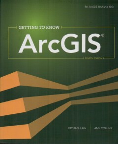
ArcGIS getting to know
Getting to Know ArcGIS, fourth edition, isw a comprehensive introduction to the features and tools of ArcGIS for Desktop. Through hands-on exercises, readers will discover, use, make, and share maps with meaningful content. The fourth edition includes new exercises on map sharing and georeferncing, new datasets and scenarios, and an introduction to ArcGIS Pro, a powerful new part of ArcGIS.Gett…
- Edisi
- -
- ISBN/ISSN
- 978-159848-382-8
- Deskripsi Fisik
- -
- Judul Seri
- -
- No. Panggil
- 910.0285 MIC a

The PyQGIS programmer's guide extending QGIS 3 with Python 3
Welcome to the world of PyQGIS, the blending of python and QGIS to extend and enchance your open source GIS toolbox. This book covers version 3.0 of the QGIS application programming interface (API), featuring Python 3. With PyQGIS you can write scripts and plugins to implement new features and perform automated tasks. This book will guide you in getting started with PyQGIS. After a brief intr…
- Edisi
- -
- ISBN/ISSN
- 978-0-9985477-2-5
- Deskripsi Fisik
- 242 hlm. : illus. ; 23,5 cm.
- Judul Seri
- -
- No. Panggil
- 910.285 GAR p

Getting started with geographic information systems
Getting started with geographic information systems is a basic-level textbook for the begining student in the relatively new field of geographic information science. Early books in GIS have tended to be rather advanced, intended for the specialist rather than the beginner. This book evolved from a tried and trusted approach is to first revisit the basic, such that all students will have the s…
- Edisi
- -
- ISBN/ISSN
- 0-13-016829-7
- Deskripsi Fisik
- xiii, 352 hlm.: illus.; 27 cm..
- Judul Seri
- -
- No. Panggil
- 910.285 KEI g
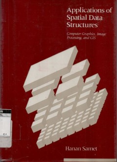
Application of spatial data structures
The book focuses on implementation techniques and theused of spatial data structures. Readers desiring a more completed introduction to these representations, including fundamental concepts, basic techniques and a broad range of possible uses, shold refer to another book by the some author. The Design and Analysis of Spatial Data Structures. The introductory material in Application os Spatial D…
- Edisi
- -
- ISBN/ISSN
- 0-201-50300-x
- Deskripsi Fisik
- xv, 507 hlm. illus.
- Judul Seri
- -
- No. Panggil
- 001.6424 HAN a

Pengembangan sistem informasi geografis untuk pengelolaan daerah aliran sunga…
Tujuan penelitian ini adalah mengembangkaan sistem informasi geografis untuk pengelolaan suatu daerah aliran sungai, sehingga terjaminnya keseimbangan hasil air sepanjang tahun. Secara khusus tujuan dari penelitian ini adalah untuk membangun sebuah kerangka kerja untuk pengelolaan DAS, mengembangkan metode pengumpulan data dan analisanya serta merancang sebuah model SIG untuk pengelolaan DAS.
- Edisi
- -
- ISBN/ISSN
- -
- Deskripsi Fisik
- -
- Judul Seri
- -
- No. Panggil
- Buku.Karya 2005/18 BAD p

Handbook of Geospatial Artificial Intelligence
- Edisi
- -
- ISBN/ISSN
- 9781032311661
- Deskripsi Fisik
- xx, 448 hlm.; 24 cm.
- Judul Seri
- -
- No. Panggil
- 910.0285 GAO h
- Edisi
- -
- ISBN/ISSN
- 9781032311661
- Deskripsi Fisik
- xx, 448 hlm.; 24 cm.
- Judul Seri
- -
- No. Panggil
- 910.0285 GAO h

Panduan pemetaan berbasis masyarakat Panduan membuat peta dan tanah adat
- Edisi
- -
- ISBN/ISSN
- -
- Deskripsi Fisik
- ix, 211 hlm. illus.
- Judul Seri
- -
- No. Panggil
- 526 ALI p
- Edisi
- -
- ISBN/ISSN
- -
- Deskripsi Fisik
- ix, 211 hlm. illus.
- Judul Seri
- -
- No. Panggil
- 526 ALI p

Membumikan informasi geospasial: kumpulan pemikiran Dr. Asep Karsidi
Buku ini memberikan gambaran menyeluruh dari informasi geospasial hasil karya big terbaru. Dan dalam buku ini mencerminkan bahwa informasi geospasial merupakan hal yang harus dibangun dn dikelola dengan baik dan benar sehingga para pemakai dapat memperoleh informasi secara benar dan dipertanggung jawabkan.
- Edisi
- -
- ISBN/ISSN
- 978-979-1291-46-0
- Deskripsi Fisik
- vi, 134 hlm. : illus.
- Judul Seri
- -
- No. Panggil
- 910.02 ASE m

Panduan dasar-dasar kartografi dan pembuatan peta dijital
- Edisi
- -
- ISBN/ISSN
- -
- Deskripsi Fisik
- ii, 89 hlm.
- Judul Seri
- -
- No. Panggil
- 526 BAM p
- Edisi
- -
- ISBN/ISSN
- -
- Deskripsi Fisik
- ii, 89 hlm.
- Judul Seri
- -
- No. Panggil
- 526 BAM p

Prinsip dasar peta tematik
- Edisi
- -
- ISBN/ISSN
- -
- Deskripsi Fisik
- 54 hlm.
- Judul Seri
- -
- No. Panggil
- 526 BAS p
- Edisi
- -
- ISBN/ISSN
- -
- Deskripsi Fisik
- 54 hlm.
- Judul Seri
- -
- No. Panggil
- 526 BAS p
 Batas Wilayah
 Ekologi
 Fotogrametri
 Geografi
 Geologi
 GIS
 Ilmu Tanah
 Kartografi
 Manajemen Bencana
 Oceanografi
 Penginderaan Jauh
 Peta