Ditapis dengan
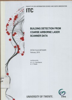
Building detection from coarse airbone laser scanner data
In developing countries, urban areas have high building densities with complex building pattern. Therefore, detecting and classifying building data can be challenging as it is difficults to separate between the building and non-building area. The buildings object from coarse ALS data which have noisy content and complexity of urban area were obtained by using information provided by topographic…
- Edisi
- -
- ISBN/ISSN
- -
- Deskripsi Fisik
- v, 59 hlm. : illus. ; 29 cm.
- Judul Seri
- -
- No. Panggil
- 621.3678 INT b

Development of an update procedure for autoritattive spatial data by the comb…
The demand for up-to-date spatial data is growing very high in this rapidly changing world. Updating the autoritative spatial data is not always associated with the updating of well established existing spatial data, but it can be extended into the additional collection of new specific themed spatial data. Unforunately, authorities who produce golden standard spatial data cannot fill those nee…
- Edisi
- -
- ISBN/ISSN
- -
- Deskripsi Fisik
- ix, 76 hlm. : 29 cm.
- Judul Seri
- -
- No. Panggil
- 910.0285 NIT d
Analisis bioekonomi dampak keberadaan rumpon terhadap kelestarian sumberdaya …
- Edisi
- -
- ISBN/ISSN
- -
- Deskripsi Fisik
- xiii, 122 hlm. illus.
- Judul Seri
- -
- No. Panggil
- 333.9164 IRM a
- Edisi
- -
- ISBN/ISSN
- -
- Deskripsi Fisik
- xiii, 122 hlm. illus.
- Judul Seri
- -
- No. Panggil
- 333.9164 IRM a
Semantic interpretation of dense urban areas of Indonesia using various class…
Airbone LIDAR data classification using machine learning algorithm has been a hot topic within the geospasial information community. LIDAR data interpretation based on point clouds is a major domain of automatic mapping. With the rapid development of urban areas, updating database of the geospasial information is urgently needed. Usually, updating of the geospatial information use manual inter…
- Edisi
- -
- ISBN/ISSN
- -
- Deskripsi Fisik
- 48 hlm. : illus. ; 30 cm.
- Judul Seri
- -
- No. Panggil
- 621.3678 TEG s
Interpretasi data anomali gaya berat di sekitar wilayah Danau Toba
- Edisi
- -
- ISBN/ISSN
- -
- Deskripsi Fisik
- vii, 55 hlm. illus.
- Judul Seri
- -
- No. Panggil
- 526.1 GUN i
- Edisi
- -
- ISBN/ISSN
- -
- Deskripsi Fisik
- vii, 55 hlm. illus.
- Judul Seri
- -
- No. Panggil
- 526.1 GUN i
Penentuan stasiun pasang surut referensi di Surabaya Benoa dan Ujungpandang
- Edisi
- -
- ISBN/ISSN
- -
- Deskripsi Fisik
- 58 hlm. illus. 31 cm.
- Judul Seri
- -
- No. Panggil
- 551.47081 ENU p
- Edisi
- -
- ISBN/ISSN
- -
- Deskripsi Fisik
- 58 hlm. illus. 31 cm.
- Judul Seri
- -
- No. Panggil
- 551.47081 ENU p
Pembuatan peta rupabumi skala khusus kabupaten Tegal Jawa Tengah menggunakan …
- Edisi
- -
- ISBN/ISSN
- -
- Deskripsi Fisik
- vi, 92 hlm.+peta illus.
- Judul Seri
- -
- No. Panggil
- 526.8 DIB p
- Edisi
- -
- ISBN/ISSN
- -
- Deskripsi Fisik
- vi, 92 hlm.+peta illus.
- Judul Seri
- -
- No. Panggil
- 526.8 DIB p
Mapping of TSM concentrations from SPOT and Landsat-TM satellite images for i…
- Edisi
- -
- ISBN/ISSN
- -
- Deskripsi Fisik
- 130 hlm.
- Judul Seri
- -
- No. Panggil
- 621.3678 WIW m
- Edisi
- -
- ISBN/ISSN
- -
- Deskripsi Fisik
- 130 hlm.
- Judul Seri
- -
- No. Panggil
- 621.3678 WIW m
Pengukuran dan penegasan perbatasan Indonesia-Malaysia di Kalimantan Timur
- Edisi
- -
- ISBN/ISSN
- -
- Deskripsi Fisik
- 108 hlm. ilus. + peta
- Judul Seri
- -
- No. Panggil
- 526.92 TOT p
- Edisi
- -
- ISBN/ISSN
- -
- Deskripsi Fisik
- 108 hlm. ilus. + peta
- Judul Seri
- -
- No. Panggil
- 526.92 TOT p
Strategy of spatial data infrastructur (SDI)development in Indonesia-action f…
- Edisi
- -
- ISBN/ISSN
- -
- Deskripsi Fisik
- xiii, 90 hlm : illus.
- Judul Seri
- -
- No. Panggil
- 910.0285 YUN s
- Edisi
- -
- ISBN/ISSN
- -
- Deskripsi Fisik
- xiii, 90 hlm : illus.
- Judul Seri
- -
- No. Panggil
- 910.0285 YUN s
 Batas Wilayah
 Ekologi
 Fotogrametri
 Geografi
 Geologi
 GIS
 Ilmu Tanah
 Kartografi
 Manajemen Bencana
 Oceanografi
 Penginderaan Jauh
 Peta