Ditapis dengan

ISPRS Journal of Photogrammetry and Remote Sensing Vol.156 October 2019
1.TreeUNet: Adaptive Tree convolutional neural networks for subdecimeter aerial image segmentation p.1-13 2.Mapping dead forest cover using a deep convolutional neural network and digital aerial photography p.14-26 3.A bridge-tailored multi-temporal DInSAR approach for remote exploration of deformation characteristics and mechanisms of complexly structured bridges p.27-50 4.Parameters determ…
- Edisi
- Vol.156
- ISBN/ISSN
- 0924-2716
- Deskripsi Fisik
- 259hlm.: illus 28cm
- Judul Seri
- -
- No. Panggil
- 526.982
ISPRS Journal of Photogrammetry and Remote Sensing Vol.157 November 2019
1.Large-scale MODIS AOD products recovery: Spatial-temporal hybrid fusion considering aerosol variation mitigation p.1-12 2.Optimizing multiscale segmentation with local spectral heterogeneity measure for high resolution remote sensing images p.13-25 3.Modelling of instrument repositioning errors in discontinuous Multi-Campaign Ground-Based SAR (MC-GBSAR) deformation monitoring p.26-40 4.Shi…
- Edisi
- Vol.157
- ISBN/ISSN
- 0924-2716
- Deskripsi Fisik
- 215 hlm.: illus 25cm
- Judul Seri
- -
- No. Panggil
- 526.982
Kajian deteksi degradasi hutan: dengan data MODIS dan landsat memahami skenar…
Dalam studi ini data multi temporal saelit Landsat resolusi spasial 30 meter periode tahun 2003, 2006 dan 2009 dan data MODIS tahun 2003 dan 2008 digunakan untuk deteksi degradasi hutan wilayah Kalimantan, khususnya Kalimantan Timur. Deteksi level degradasi hutan menggunakan metode deteksi perubahan (change detection) dan analisa fragmentasi (fragmentation analisis). Kategori fragmentasi diten…
- Edisi
- -
- ISBN/ISSN
- 978-602-9439-04
- Deskripsi Fisik
- vi, 35 hlm. : illus.
- Judul Seri
- -
- No. Panggil
- 621.3678 SUH k
ISPRS Journal of Photogrammetry and Remote Sensing Volume 167 September 2020
1. A low-cost UAV framework towards ornamental plant detection and counting in the wild p.1-11 2. X-ModalNet: A semi-supervised deep cross-modal network for classification of remote sensing data p. 12-33 3. Mapping quality prediction for RTK/PPK-equipped micro-drones operating in complex natural environment p. 24-38 4. Vehicle detection of multi-source remote sensing data using active fine-t…
- Edisi
- Volume 167 September 2020
- ISBN/ISSN
- 0924-2716
- Deskripsi Fisik
- 457 hlm. : illus. ; 28 cm.
- Judul Seri
- -
- No. Panggil
- 526.982
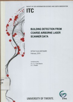
Building detection from coarse airbone laser scanner data
In developing countries, urban areas have high building densities with complex building pattern. Therefore, detecting and classifying building data can be challenging as it is difficults to separate between the building and non-building area. The buildings object from coarse ALS data which have noisy content and complexity of urban area were obtained by using information provided by topographic…
- Edisi
- -
- ISBN/ISSN
- -
- Deskripsi Fisik
- v, 59 hlm. : illus. ; 29 cm.
- Judul Seri
- -
- No. Panggil
- 621.3678 INT b
Semantic interpretation of dense urban areas of Indonesia using various class…
Airbone LIDAR data classification using machine learning algorithm has been a hot topic within the geospasial information community. LIDAR data interpretation based on point clouds is a major domain of automatic mapping. With the rapid development of urban areas, updating database of the geospasial information is urgently needed. Usually, updating of the geospatial information use manual inter…
- Edisi
- -
- ISBN/ISSN
- -
- Deskripsi Fisik
- 48 hlm. : illus. ; 30 cm.
- Judul Seri
- -
- No. Panggil
- 621.3678 TEG s
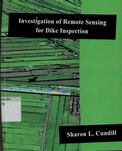
Investigation of remote sensing for dike inspection
This thesis investigates the use of optical remote sensing as proxies for the inspection of grass covered dikes. The proof of concept showed that significant relationship exist between various ground bases optical remote sensing data and the two indicators. These were refined for use with airbone and space borne sensors and suggestions for operational implementation for dike inspection are give…
- Edisi
- -
- ISBN/ISSN
- 978-90-365-4036-0
- Deskripsi Fisik
- xxviii, 200 hlm. : illus.
- Judul Seri
- -
- No. Panggil
- DS 621.3678 SHA i

Remote sensing : praktis penginderaan jauh dan pengolahan citra dijital denga…
Remote sensing adalah salah satu metode pengamatan atau pengukuran unsur-unsur spasial permukaan bumi. Metode yang sangat efektif dan efisien ini banyak memiliki varian vrian dalam menyediakan rekaman data spasialnya. Selanjutnya untuk meningkatkan data spasialnya, dilakukan proses-proses pengolahan citra dijital. Dalam kaitan inilah hadir ER Mapper dengan peran sentralnya. ER Mapper adalah sa…
- Edisi
- -
- ISBN/ISSN
- 978-979-1153-30-0
- Deskripsi Fisik
- xiv, 406 hlm. illus.
- Judul Seri
- -
- No. Panggil
- 621.3678 EDD r
ISPRS Journal of Photogrammetry and Remote Sensing Volume 182 December 2021
1. Analyzing multi–domain learning for enhanced rockfall mapping in known and unknown planetary domains p. 1-13 2. Progressive split-merge super resolution for hyperspectral imagery with group attention and gradient guidance p. 14-36 3. ResDLPS-Net: Joint residual-dense optimization for large-scale point cloud semantic segmentation p. 37-51 4. A hierarchical self-attention augmented Lap…
- Edisi
- Vol. 182 December 2021
- ISBN/ISSN
- 0924-2716
- Deskripsi Fisik
- 241 hlm.: iluss.; 28 cm.
- Judul Seri
- -
- No. Panggil
- 526.982
ISPRS Journal of Photogrammetryand Remote Sensing Volume 168 October 2020
1. See the forest and the trees: Effective machine and deep learning algorithms for wood filtering and tree species classification from terrestrial laser scanning p. 1-16 2. Pruning multi-view stereo net for efficient 3D reconstruction p. 17-27 3. Influence of ULS acquisition characteristics on tree stem parameter estimation p.28-40 4. The impact of anthropogenic land use change on the prote…
- Edisi
- Volume 168 October 2020
- ISBN/ISSN
- 0924-2716
- Deskripsi Fisik
- 306 hlm. : illus. ; 28 cm.
- Judul Seri
- -
- No. Panggil
- 526.982
 Batas Wilayah
 Ekologi
 Fotogrametri
 Geografi
 Geologi
 GIS
 Ilmu Tanah
 Kartografi
 Manajemen Bencana
 Oceanografi
 Penginderaan Jauh
 Peta