Ditapis dengan

Remote sensing and image interpretation
The front cover a topographic image derived for airborne lidar data, two days affer the massive Oso landslide (March 2014, in Washington State). With more than forty deaths and nearly fiffy homes destroyed, this event ranks among the deadliest kandslides in U.S. history. Lidar (light detection and ranging, Chapter 6) is an active remote sensing technique that ivolves transmitting pulses of l…
- Edisi
- -
- ISBN/ISSN
- 0-471-85462-x
- Deskripsi Fisik
- 721 hlm. ilus.
- Judul Seri
- -
- No. Panggil
- 621.3678 THO r

Proceeding Mapping and Remote Sensing tools for the 21st Century, Conference …
- Edisi
- -
- ISBN/ISSN
- 1-57083-012-6
- Deskripsi Fisik
- vii, 240 hlm. : illus.
- Judul Seri
- -
- No. Panggil
- 621.3678 UNI p
- Edisi
- -
- ISBN/ISSN
- 1-57083-012-6
- Deskripsi Fisik
- vii, 240 hlm. : illus.
- Judul Seri
- -
- No. Panggil
- 621.3678 UNI p

Practical handbook for wetland identification and delineation
The second edition of the bestselling Practical Handbook for Wetland Identification and Delineation offers solutions to real-world problems in the scientific and regulatory aspects of wetlands. The authors present characteristics and indicators of wetlands that are the focus of the jurisdictional issue, and discuss strategies and methods for making wetland identifications and delineations that …
- Edisi
- 2nd Edition
- ISBN/ISSN
- 978-1-4398-3891-4
- Deskripsi Fisik
- xi, 196 hlm. : illus.
- Judul Seri
- -
- No. Panggil
- R 574.5 JOH p

Himpunan perubahan peraturan kepegawaian terakhir 1994/1995 keputusan Ketua B…
- Edisi
- -
- ISBN/ISSN
- -
- Deskripsi Fisik
- xlix, 940 hlm.
- Judul Seri
- -
- No. Panggil
- 342.03 IND h
- Edisi
- -
- ISBN/ISSN
- -
- Deskripsi Fisik
- xlix, 940 hlm.
- Judul Seri
- -
- No. Panggil
- 342.03 IND h

Pengaruh reformasi administrasi perpajakan terhadap kepatuhan wajib pajak= th…
- Edisi
- -
- ISBN/ISSN
- -
- Deskripsi Fisik
- 62 hlm.
- Judul Seri
- -
- No. Panggil
- 343.04 CHA p
- Edisi
- -
- ISBN/ISSN
- -
- Deskripsi Fisik
- 62 hlm.
- Judul Seri
- -
- No. Panggil
- 343.04 CHA p

Hukum kepolisian
- Edisi
- -
- ISBN/ISSN
- -
- Deskripsi Fisik
- 220 hlm.
- Judul Seri
- -
- No. Panggil
- 343.01 MOM h
- Edisi
- -
- ISBN/ISSN
- -
- Deskripsi Fisik
- 220 hlm.
- Judul Seri
- -
- No. Panggil
- 343.01 MOM h

Pengantar ilmu hukum tata negara
- Edisi
- -
- ISBN/ISSN
- 978-979-769-210-0
- Deskripsi Fisik
- viii, 461 hlm.
- Judul Seri
- -
- No. Panggil
- 342.598 JIM p
- Edisi
- -
- ISBN/ISSN
- 978-979-769-210-0
- Deskripsi Fisik
- viii, 461 hlm.
- Judul Seri
- -
- No. Panggil
- 342.598 JIM p
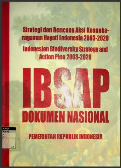
Strategi dan rencana aksi keaneka ragaman hayati Indonesia 2003-2020, IBSAP J…
- Edisi
- -
- ISBN/ISSN
- 979-96149-9-6
- Deskripsi Fisik
- iv, 79 hlm. : illus.
- Judul Seri
- -
- No. Panggil
- 333.95 BAP s
- Edisi
- -
- ISBN/ISSN
- 979-96149-9-6
- Deskripsi Fisik
- iv, 79 hlm. : illus.
- Judul Seri
- -
- No. Panggil
- 333.95 BAP s
Sekitar Catatan: Hukum Administrasi Kepegawaian
- Edisi
- Cetakan Pertama
- ISBN/ISSN
- -
- Deskripsi Fisik
- -
- Judul Seri
- -
- No. Panggil
- 342.068 SUM s
- Edisi
- Cetakan Pertama
- ISBN/ISSN
- -
- Deskripsi Fisik
- -
- Judul Seri
- -
- No. Panggil
- 342.068 SUM s
Himpunan peraturan perundang-undangan pajak pertambahan nilai tahun 1987-1988
- Edisi
- -
- ISBN/ISSN
- -
- Deskripsi Fisik
- 548 hlm.
- Judul Seri
- -
- No. Panggil
- 343.055 IND h
- Edisi
- -
- ISBN/ISSN
- -
- Deskripsi Fisik
- 548 hlm.
- Judul Seri
- -
- No. Panggil
- 343.055 IND h
 Batas Wilayah
 Ekologi
 Fotogrametri
 Geografi
 Geologi
 GIS
 Ilmu Tanah
 Kartografi
 Manajemen Bencana
 Oceanografi
 Penginderaan Jauh
 Peta