Ditapis dengan

Petunjuk pengumpulan nama-nama geografi dari peta skala 1:50.000 (Dok.No.15/1…
Gazetteer Nasional nama-nama Geografi yang diterbitkan oelh Bakosurtanal pertama kali memuat sejumlah 9760 nama yang disadap dari peta dunia skala 1: 1.000.000 (dokumen no. 12/1978). Nama -nama geografi tersebut telah disimpan dalam bentuk basis data dalam magtape. Sebagai tindak lanjut pengelolaan data-data dasar geografi dan perpetaan, dengan petunjuk dokumen ini akan dilaksanakan penyadapan …
- Edisi
- -
- ISBN/ISSN
- -
- Deskripsi Fisik
- -
- Judul Seri
- -
- No. Panggil
- Dokumen 1980/15 BAD p
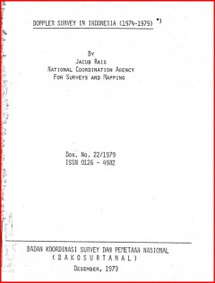
Doppler survey in Indonesia (1974-1979) (Dok.22/1979)
Indonesia has started the implementation of a systematic mapping programme of the country to provide base maps at scale of 1:50.000 for the inventory and evaluation of her vast natural as well as her socio-economic resources for teir visual presentation and storage in the resources information systems. For these purpose it is necessary for these maps to be based on unified coordinate system pro…
- Edisi
- -
- ISBN/ISSN
- -
- Deskripsi Fisik
- -
- Judul Seri
- -
- No. Panggil
- Dokumen 1979/22 BAD d

Laporan akhir bimbingan teknis penyusunan NSDA spasial di Prop. Babel, Bali, …
Secara garis besar maksud dari bimbingan teknis ini adalah pembinaan kualitas SDM Instansi Sektoral terkait dan Bappeda dengan cara memberikan pengetahuan praktis tentang cara inventarisasi data sumberdaya alam dengan bantuan inderaja dan SIG, pengolahan data primer dan sekunder untuk penyusunan NSASD yang diharapkan akan sejalan dengan otonomi daerah, sehingga daerah dapat mengelola dan menyus…
- Edisi
- -
- ISBN/ISSN
- -
- Deskripsi Fisik
- 30 hlm.; 18 cm.
- Judul Seri
- -
- No. Panggil
- 333.73Buku.Karya 2002/38 BAD l

Jaring kontrol geodesi nasional dengan pengukuran global positioning system d…
- Edisi
- -
- ISBN/ISSN
- -
- Deskripsi Fisik
- -
- Judul Seri
- -
- No. Panggil
- Dokumen 2004/02 BAD j
- Edisi
- -
- ISBN/ISSN
- -
- Deskripsi Fisik
- -
- Judul Seri
- -
- No. Panggil
- Dokumen 2004/02 BAD j

Plan of operation resource evaluation aerial photography Indonesia project nu…
The Purpose of this plan of operation is to record the understanding between BAKOSURTABNAL representing the goverment of the Republic of Indonesia and CIDA, representing the goverment of Canada, on the purpose of the project, the method and shedule for achieving that purpose, the resources required, and the means of managing and evaluating the achievement of the project purpose. The responsibil…
- Edisi
- -
- ISBN/ISSN
- -
- Deskripsi Fisik
- -
- Judul Seri
- -
- No. Panggil
- Dokumen 1984/08 BAD p

Laporan penelitian pemanfaatan foto udara skala kecil (Dok.No.14/1984)
Laporan penelitian pemanfaatan foto udara bertujuan untuk merancang suatu sistem pemetaan yang dari segi tenaga, biaya dan waktu secara efisien dapat memenuhi kebutuhan IPEDA dan kadaster, yaitu menghasilkan peta dasar skala besar daerah pedesaan dengan memanfaatkan secara optimal sarana yang tersedia dalam program pemetaan dasar nasional.
- Edisi
- -
- ISBN/ISSN
- -
- Deskripsi Fisik
- -
- Judul Seri
- -
- No. Panggil
- Dokumen 1984/14 BAD l

Agreed record of discussions of the 6th joint technical sub-committee meeetin…
The Meeting commenced at 8.30 am on the 5th of July 1986 and was chaired by Mr. Pomaleu Salaiau, the head of Papua New Guinea Delegation. Members of the delegations from Papua New Guinea and ndonesia are attached as annex A and annex B respectively. The following agenda has been agreed upon by the head of both delegation: 1. Opening session; 2. Matters arising out of the minutes of (a) 5th join…
- Edisi
- -
- ISBN/ISSN
- -
- Deskripsi Fisik
- -
- Judul Seri
- -
- No. Panggil
- Dokumen 1991/06 BAD a

Katalog informasi geospasial dasar (Jawa, Bali, Nusa Tenggara)
Seiring dengan Terbitnya Undang-Undang No. 4 Tahun 2011 tentang Informasi Geospasial permintaan layanan informasi geospasial dari waktu ke waktu dirasakan semakin meningkat , hal ini merupakan perkembangan yang positif dimana masyarakat pengguna semakin memahami bahwa informasi geospasial merupakan bagian penting dalam mewwujudkan sistem informasi yang dapat dimanfaatkan untuk mendukung sektor …
- Edisi
- -
- ISBN/ISSN
- -
- Deskripsi Fisik
- iii, 115 hlm. : illus.
- Judul Seri
- -
- No. Panggil
- Katalog.BIG 2016/51.IX BAD k

Agreed record of discussions of the 5th joint technical sub-committee meeting…
The Meeting commenced at 09.00 A.M. on July 8, 1985 and was chaired by Prof. Jacub RAis, the head of the Indonesia delegation. The PNG delegation accepted the agenda of the meeting put forward by the Indonesian delegation. The adopted Agenda is as follows: 1.Opening; 2.Discussion on matters arising out of 1984 meetings (fourth JTSC meeting in Madang and ird JBC meeting in Surabaya); 3.Exchange …
- Edisi
- -
- ISBN/ISSN
- -
- Deskripsi Fisik
- -
- Judul Seri
- -
- No. Panggil
- Dokumen 1991/05 BAD a

Agreed record of discussions of the first joint technical sub-committee meeti…
Meeting commenced at 0900 on 29th April 1982, and considered an agenda put forward by the Indonesian side. Papua New guinea suggested some amendements.
- Edisi
- -
- ISBN/ISSN
- -
- Deskripsi Fisik
- -
- Judul Seri
- -
- No. Panggil
- Dokumen 1991/01 BAD a
 Batas Wilayah
 Ekologi
 Fotogrametri
 Geografi
 Geologi
 GIS
 Ilmu Tanah
 Kartografi
 Manajemen Bencana
 Oceanografi
 Penginderaan Jauh
 Peta